It’s nearly one week into the Covid 19 lockdown. Council were not able to retrieve dying and dead birds from the pond at Tahuna Torea. The birds have been dying from avian botulism which paralyse them (its a horrible way to go). I took a pied stilt to the vet but it did not make it and cleaned up other dead and dying geese and mallards.
While I was there I noticed a lot of trash that had become exposed, as the water was the lowest it’s been in at least 10 years. Going back to pick it up I found it was mostly bread bags taken to the pond to feed the birds. I understand the commonly known reasons for not feeding birds. But I had no idea how much plastic goes into the water as byproduct of the practice. Light can not penetrate the dark pond waters and the plastic doesn’t break down. Sediment settles on top and where ever I dug into the dried mud I found plastic.
I’ll spend a few more hours gathering it but I’ll never get it all. I’m sure other ponds are similar if not worse. As long as we keep selling bread in plastic, bird feeding will be contributing to our plastic legacy.
UPDATE: 5 April
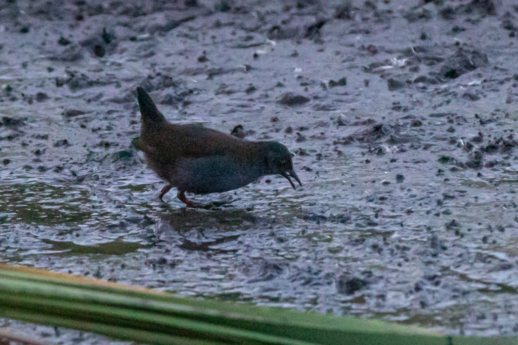
After removing three black sacks of dead birds and soft plastics I was rewarded with seeing this secretive bird feeding right where I had been cleaning up 😀
Spotless Crake
UPDATE: 12 April
So far I have retrieved two geese, four mallards, one juvenile black-backed gull and four black sacks full of plastic, mostly bread bags.
Bailey Tanks make their water storage tanks from plastic which comes into the business as small pellets. Since August 2017 I have seen these plastic pellets coming out of their business at 36 Ash Rd, Wiri and into the local stream where it flows into the Manuaku Harbour. I have been regularly reporting the pollution to Auckland Council who have been asking the business to clean up their act, they were fined $750 on the in May 2017 however the plastic keeps coming out.
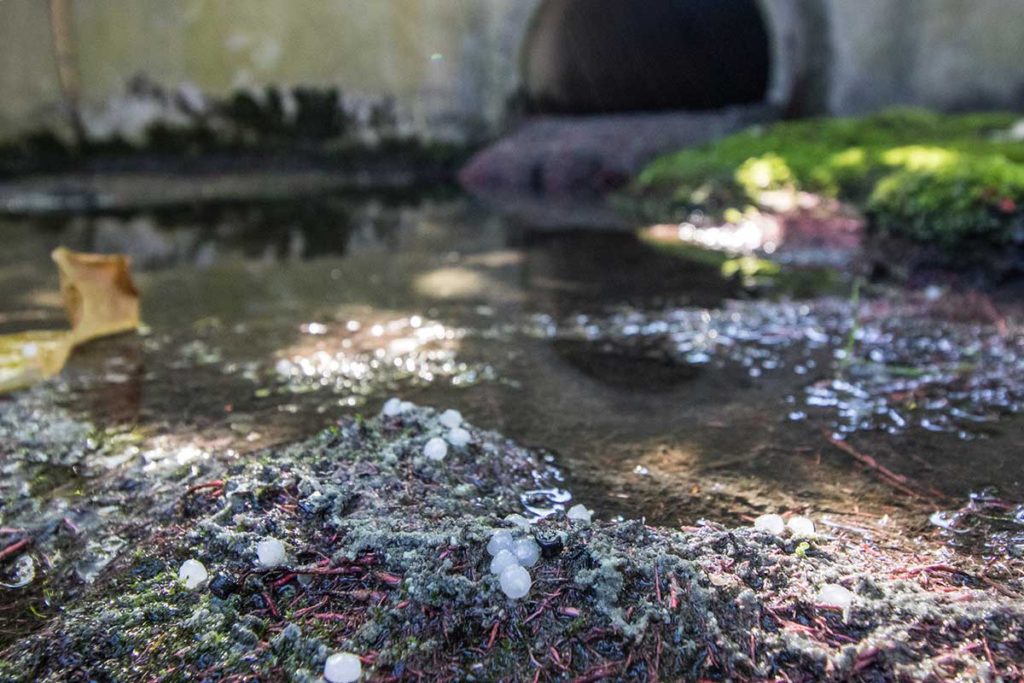
Bailey Tanks stormwater outlet (August 2017)You can see the small plastic pellets littering their yard from the street (9 Feb 2020 Council job number INR60232011).Plastic pellets (nurdles) at stormwater pipe exiting the Bailey Tanks (9 May 2019 Council Job number #8260221120).
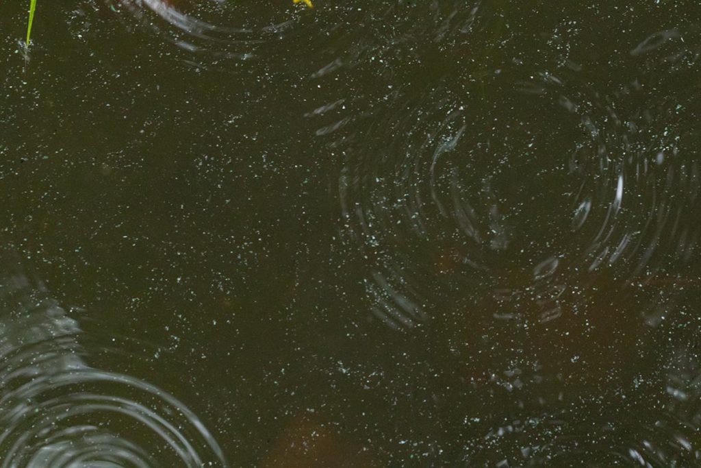
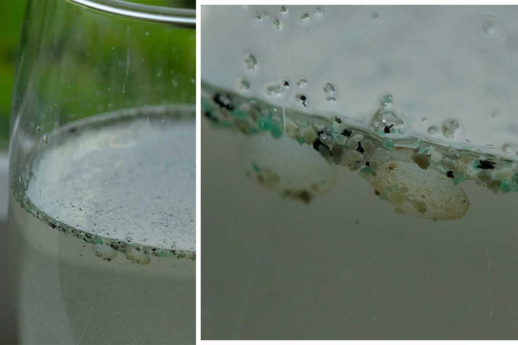
Today (22 February 2020) I thought I would go and see if the rain would increase the amount of plastic washing to the stream. Pallets were coming but I was horrified to see the surface of the water covered in a fine plastic powder which they also use to make their products. Council job number 8260232660.
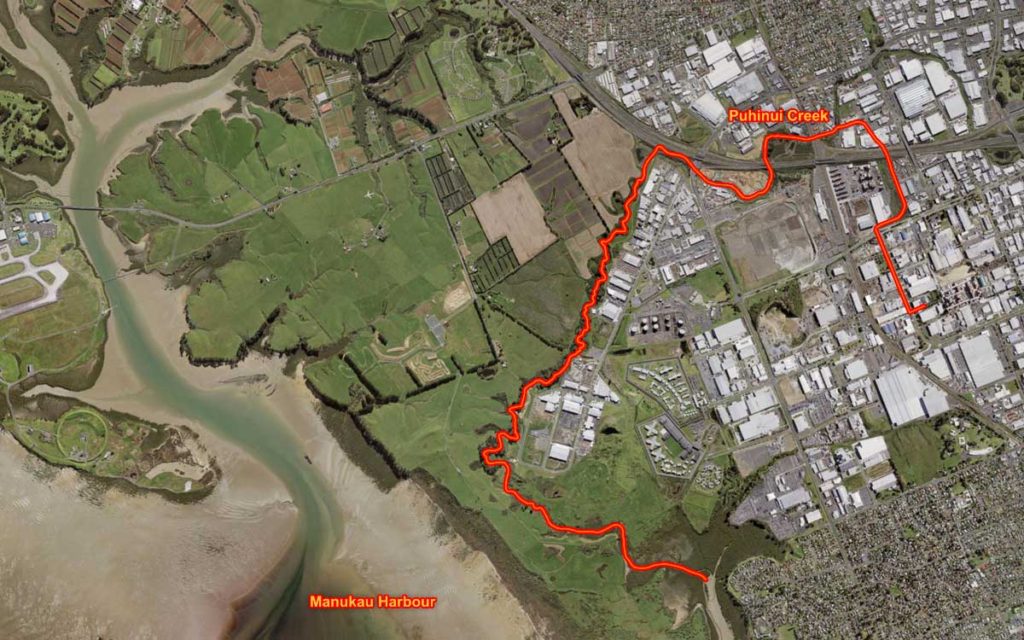
I took a sample home to have a better look at these micro plastics close up.This is the path the pollution takes from the stormwater outlet to Puhinui Creek and then the Manukau Harbour. Map constructed using data from Auckland Councils Geomaps service.
Industrial pollution is usually event based, where a business has accidentally spills something and creates a pollution incident. This kind of slow leak is much worse, I hate to think how much plastic this company has dumped into the Manukau Harbour where it poisons our wildlife.
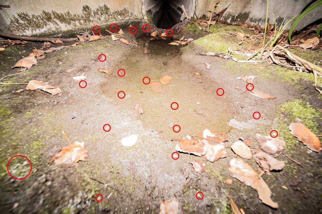
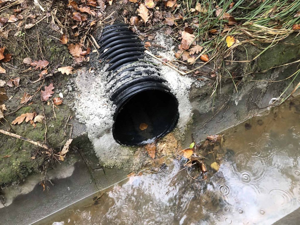
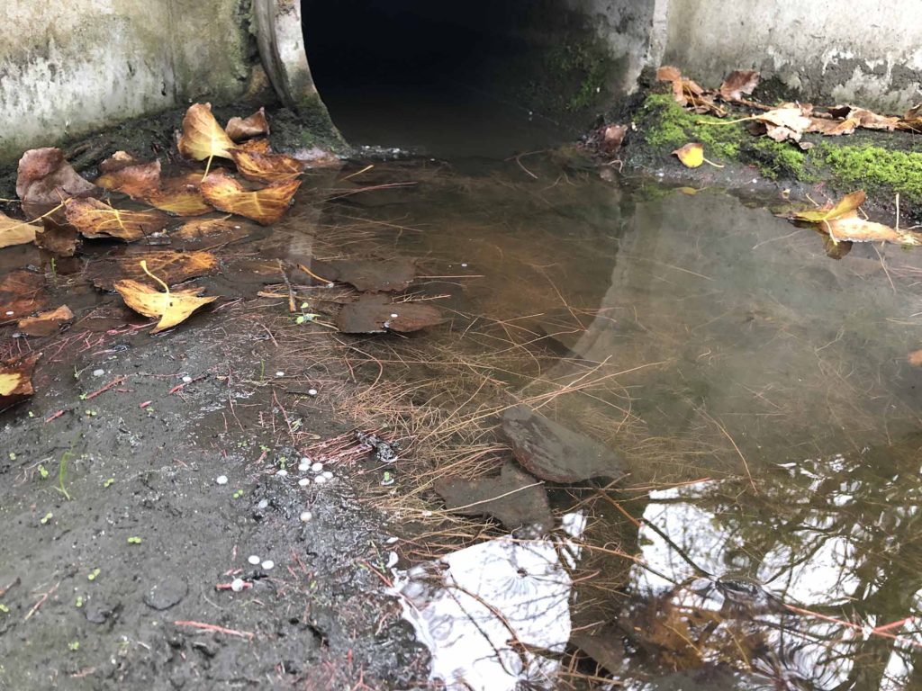
A new pipe has been installed upstream and was flowing clear when I visited at 3pm today.But the old pipe continues to leak plastic. It took 20 minutes to log the incident with Auckland Council (Job number 8100624496) during which time I counted 18 plastic pellets exiting the pipe. I said I would wait for the officer (to show them the pollution) but I got a text back saying they will not visit until tomorrow.
UPDATE 12 JUNE 2020 I followed up on the the job number above (8100624496) to find out that officers did not visit the site to investigate the incident. I requested a site visit with officers but they refused.
UPDATE 13 OCTOBER 2020
The site was the cleanest I had ever seen, the business is clearly trying to clean up their act which is great. (Just one plastic pellet sighted). It’s a shame that they just cant stop leaking plastic tho. Check out the tiny bits of plastic powder in this video. Council RM Incident 8620239074, INR60239074.
UPDATE 25 FEBRUARY 2024
First significant rain in weeks today. Checked 9am after it had been raining for about 45minutes. Very pleased to not see plastic in the water.
In October 2019 I was discussing bycatch (animals killed by fishers that they can’t sell) and was referred to this website http://psc.dragonfly.co.nz/ which maps threatened seabirds, marine mammals, and turtles that are caught during commercial fishing operations. Some of the data mentions photos so I requested recent ones in the Hauraki Gulf (where I spend most of my time) from the Ministry of Fisheries. They could not just send me all the photos so I did a more detailed request, 77 days later I got the photos, they are very low resolution and have been heavily edited but it gives you a sense for how commercial fishing impacts species that are threatened with extinction.
Flesh-footed shearwater. Killed by a small vessel bottom long lining.
Takoketai. Killed by small vessels in inshore trawling.
Takoketai. Killed by small vessels in inshore trawling.
Bottlenose dolphin. Killed by inshore trawl fisheries (net).
Flesh-footed shearwater. Killed by small vessels in snapper longline fisheries (hook).
Takoketai. Killed by inshore trawl fisheries (net).
Flesh-footed shearwater. Killed by small vessels in snapper longline fisheries (hook).
Common dolphin. Killed by small vessels in inshore trawl fisheries (net).
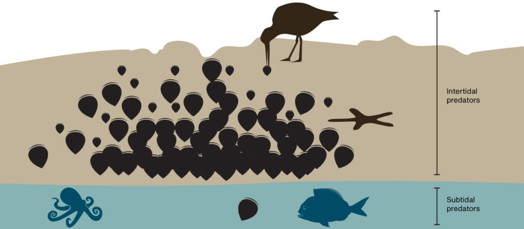
Marine restoration is a lazy business. All you have to do is stop fishing an area and marine ecosystems heal themselves. However this is not the case with green-lipped mussels in New Zealand.
100’s of square kilometres of sub-tidal mussel beds were fished to extinction in each harbour around New Zealand.
The industry collapsed and more than half a century later they have not returned. In the Hauraki Gulf there are a few places you can still find Green-lipped mussels. You would think that these places would be deep under the ocean (Green-lipped mussels have been found at 50m deep), but they are not.
Most are in the intertidal zone on rocky shores. Here there is usually a gradient with mussels thin higher up and getting thicker towards the low tide mark where the abruptly stop. I have asked several local experts and no one has a solid answer why they stop so abruptly.
As we spend 100’s of thousands of dollars restoring sub-tidal beds maybe the key to unlocking a lazier (and cheaper) solution is staring us in the face. Here are some thoughts on why the line exists:
Avian predation. Every exposed mussel bed has at least one pair of Variable oystercatcher eating the smaller mussels every low tide. So living in the subtidal zone would be of some advantage but we are more likely to see juveniles higher up. This suggests there is even more predation from below.
Starfish predation. Eleven-armed star fish were a big problem in the first beds put down by Revive our Gulf. However starfish do okay in the intertidal zone and are not particularly abundant in intertidal beds. We don’t see lots of them waiting below the low tide mark next to intertidal mussel reefs.
Fish predation. This seems like the most obvious cause but surely it can’t be Snapper as they have been fished down to 20% of their natural biomass. Rays are a possibility but I thought I would see more of them in the shallows if this was the case. This southern study looked at predation and found it to be largely subtidal and nocturnal, by fish and large crabs.
Octopus predation. They are nearly invisible and love eating mussels so at first this is a good fit. But octopus leave the shells, I will look for evidence on the next intertidal bed I explore. None of the predation theories show why the line is so strong.
Food. Mussels eat phytoplankton and algae. I am sure there will be more of this close to the surface. I am pretty sure this is why mussel farmers grow their mussels high in the water column. Wild mussels might also benefit from wave action on the rocks as it would increase the oxygen in the water. However I would have thought that these benefits would be offset by the fact they can’t feed while they are exposed to the air.
Sediment. If there is some other benefit to being exposed to the air maybe it’s that the water in the Gulf just has too much stuff in it. Mussels have to work hard sorting out the food from the dirt, maybe mussels are not good at taking a break and being forced to is good for them. Comparing the condition of intertidal and sub-tidal mussels would help dismiss this idea.
Or maybe like a lot of things in biology it’s a mixture of the above factors. As we are slowly losing our intertidal mussel beds it might be wise to set up a long-term monitoring project that might solve this mystery and inspire lazier restoration methods.
I have 1,612 verified observations on iNaturalist between Auckland and Whangarei documenting 552 species (mostly invertebrates) covering forest, freshwater, intertidal and marine habitats. I don’t take many photographs of plants. Of these observation 96 or 17% of species were introduced. Here is a break down showing areas where I have found more or less introduced species:
Hauturu
Aotea
Tawharanui
East Auckland
Waitakeres
Hunua Ranges
Rangitoto / Motutapu / Motuihe
Motukorea
Mungatapere
Observations
206
149
141
197
77
94
71
33
159
Species
86
84
86
120
57
64
52
25
83
Introduced
6
12
8
35
1
4
11
4
9
Percent introduced
7
14
9
29
2
6
21
16
11
I expected the restored and protected islands in the Hauraki Gulf to have a smaller percent of introduced species. I think the high number of introduced species (compared to the Waitakeres and the Hunua Ranges) reflects the islands farmed history with islands like Motukorea and Motutapu still dominated by kikuyu. The larger and older the forest the more indigenous biodiversity.
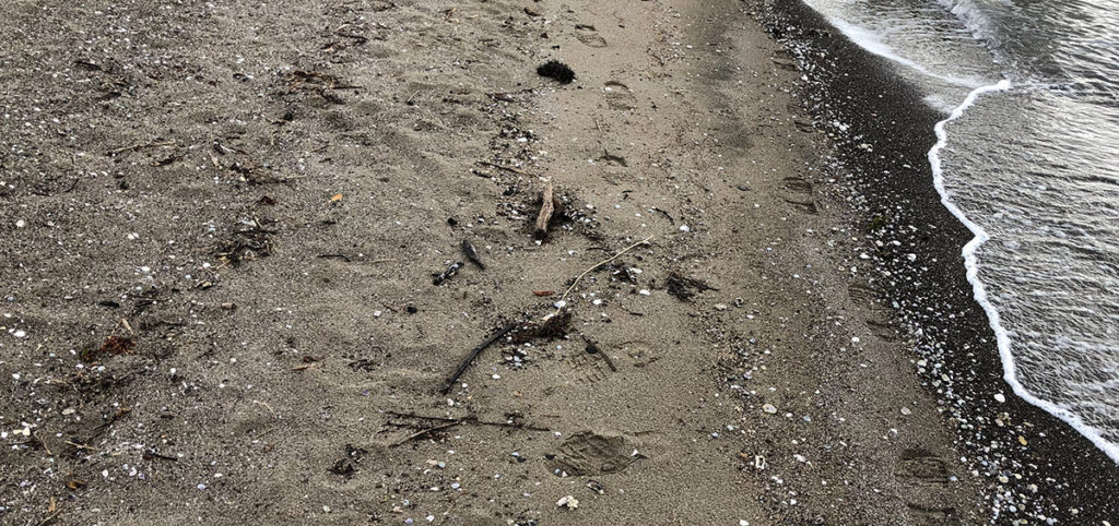
I teamed up with computer and environmental scientist Jordi Tablada to build a website for identifying New Zealand animal sign. I met Jordi through the New Zealand Dotterel Forum as he looks after dotterel at Piha. We had overlapping skills and were looking for a project to collaborate on. He came to me with the idea inspired by some materials produced by another dotterel minder Emily Roberts.
Now when I spot tracks in the sand and wonder what made them I load up the website and check them against the examples. It’s working really well and I hope to expand it to include other animal sign and more species. Others are using it too, mostly due to some great press. It was inspiring to see another citizen science identification guide go live this morning which will also help on beaches. This one is for shells.
These guides join others produced by organisations like nzbirdsonline.org.nz and help users of tools like eBird and iNaturalist.nz map the diversity and abundance of New Zealand flora and fauna.
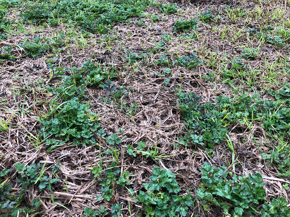
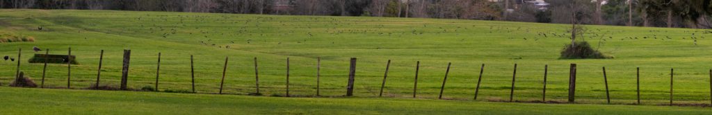
With a lot more mowing at Point England this Winter the flocks of South Island pied oystercatcher are leaving a visible sign in the paddock. The probe holes are very dense right to the edges of the paddocks which means that I am also seeing holes from other species like White-faced heron and Pukeko. Casual counts put the number of little holes at around 100 per square meter.
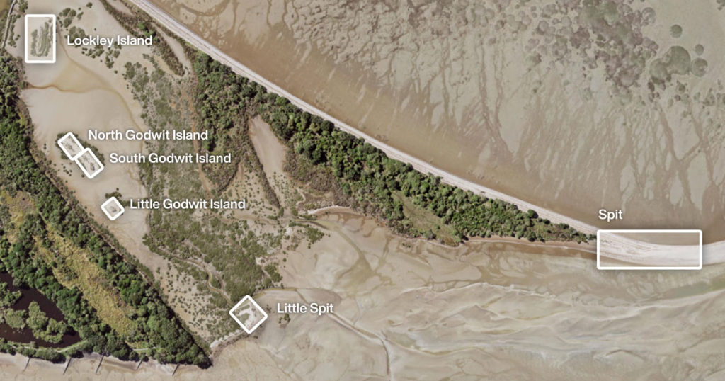
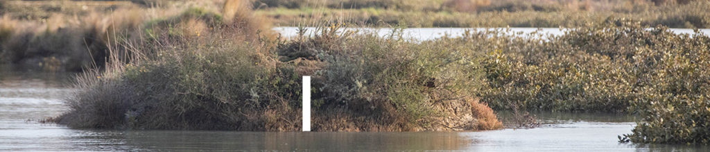
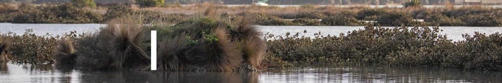
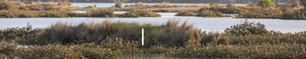
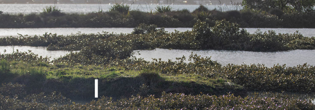
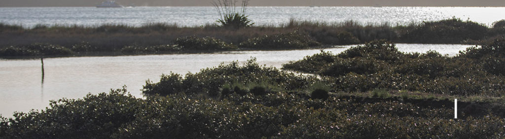
Today I took photos of the shorebird roosts at Tahuna Torea when the tide had just covered the main spit roost. The tide height was predicted to be very high today (3 August 2019) at 3.4M Westhaven 8:53am. Conditions were relatively calm and the tide had not (yet) hit the high tide line on the Little spit.
Names and locations of roostsThe tide was about 20cm (in height) from the high tide line.And the pathway which is sometimes flooded was about 20cm above the water.The spit had just been compromised with just a few Black-back gulls and one Caspian tern remainingLittle spit was about 50cm above the tideLittle Godwit Island was about 60cm above the tideSouth Godwit Island was about 75cm above the tideNorth Godwit Island had about 40cm above the tideThe Southern end of Lockley Island had about 40cm above the tideThe Northern end of Lockley Island had about 40cm above the tide
I have seen tidal debris in the mangroves around Lockley Island that were above the height of the island (indicating that it sometimes gets swamped) but I think it would have made an ok roost today.
I was recently lucky enough to monitor kiwi on Hauturu with the Little Barrier Island Supporters Trust. I have done this many times before at Tāwharanui with TOSSI. The exercise involves a good hike to the destination at night then sitting quietly in the dark listening to the sounds of the forest for a couple of hours. I have met some great people doing this and this trip was no exception. They patiently waited for me as I inched along the tracks on the way back to the hut, inspecting every tree for hidden treasures and some even came out with me again on their free nights. I have posted all my invertebrate observations here on iNaturalist where the community is helping me identify them all. I have also posted some fungi which were a hot topic among the volunteers.
It’s an incredible island where one can get a sense for pre-human New Zealand. Here is a list of some observations I made over the 12 days I was there.
I saw less invertebrates, birds and geckos at elevation.
Piwakawaka following Tieke on two occasions.
By weight there was much more industrial plastic pollution (mussel floats) than domestic plastic pollution on the beaches.
Similar gecko numbers in winter compared to summer. One seen every 20 minutes on night walks.
Cave Weta were the dominant weta by a factor of 10 or more. Tree Weta, Ground weta and Wētāpunga active.
Winter invertebrate abundance similar to mainland sites with predator control (and less birds). At night, in two out of three tress invertebrates were easily found.
Invertebrates not much bigger than raindrops stay hidden during the rain.
NZ Giant Centipede found 3m above ground inside a Kanuka tree that fell in the middle of the day. The species is very arboreal.
Korimoko chasing Ruru during the day.
Flock of 18 Kereru feeding on Muehlenbeckia.
A high of 12 Shore Skinks seen from one observation point. No other skinks observed.
Invertebrate diversity high with many species I had not seen before. Some had not been previously photographed in the wild.
Strange absence of Katydid calls.
Very empty streams with only Shortfinned Eel and Banded Kokopu observed. Huge flushing events the likely cause of low freshwater diversity and abundance.
The artificial intelligence that reads photos on iNaturalist and identifies species is incredible. It often makes me double check an ID and has helped on many occasions. However I was pleased to see it bested by this stick insect I photographed who completely out-witted it 😀