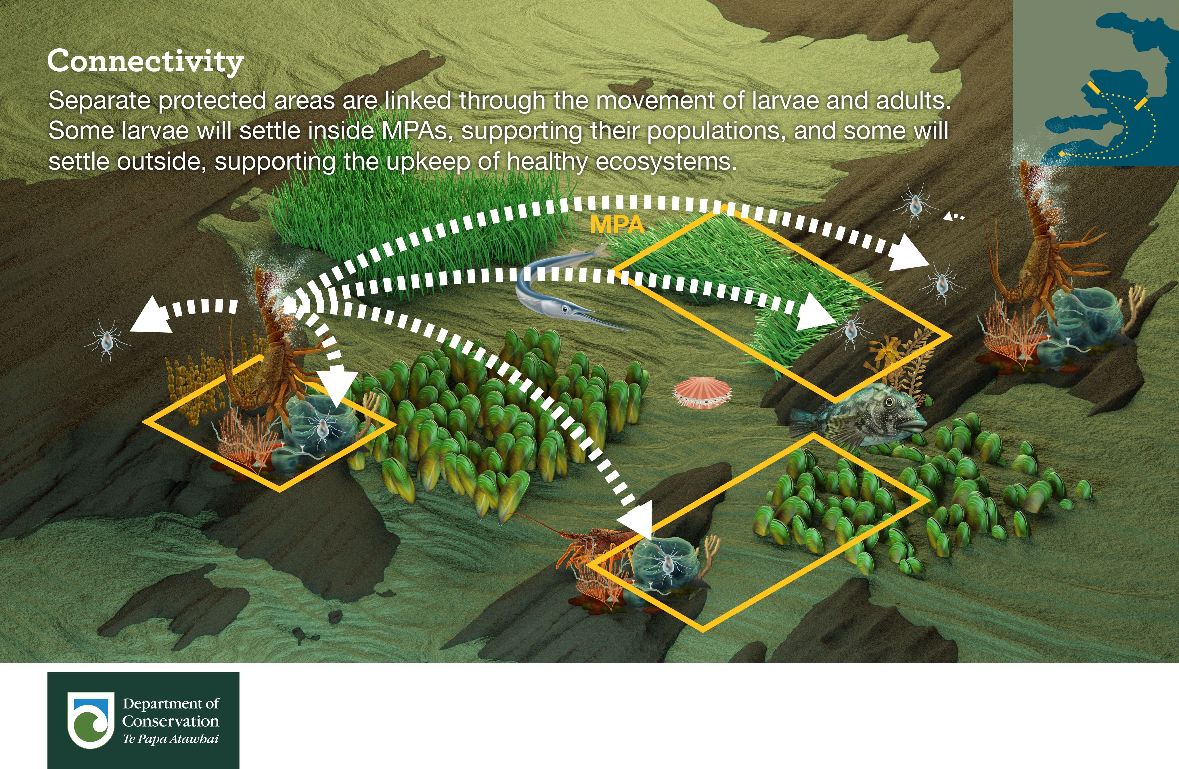
Produced by the Northern New Zealand Seabird Trust with support from G.I.F.T and the Hauraki Gulf Forum. Read the report here.


Mostly just stuff I am doing to help the planet

Produced by the Northern New Zealand Seabird Trust with support from G.I.F.T and the Hauraki Gulf Forum. Read the report here.
Yesterday I checked about 10km of beach for kekeno / New Zealand fur seals in Mercury Bay , Coromandel including Wharekaho, Kuaotunu, Otama, Opito, Matapaua. I did not find any alive or dead. The beaches were largely empty but I did ask five locals to keep an eye out and report them as part of a study I am helping DOC with in the area. One person was aware of the study.
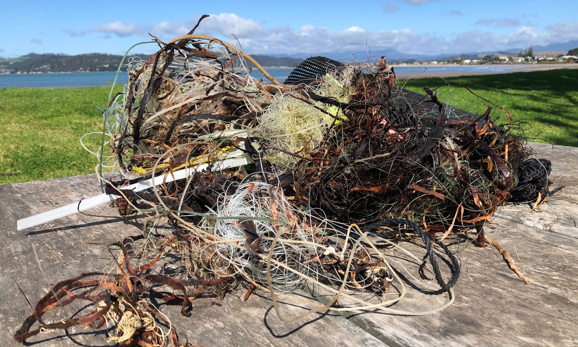
I noticed a few bits of fishing line washed up on the high tide line left by dirty fishers at Wharekaho / Simpsons Beach. I picked up all the bits I could find for 1km East of Stormont Lane. I counted 57 bits of rubbish, many were tangled knots of nylon which pose a danger to shorebirds who can get their toes caught in it (see photo above).
Dotterel counts for the above beaches logged on iNaturalist.nz
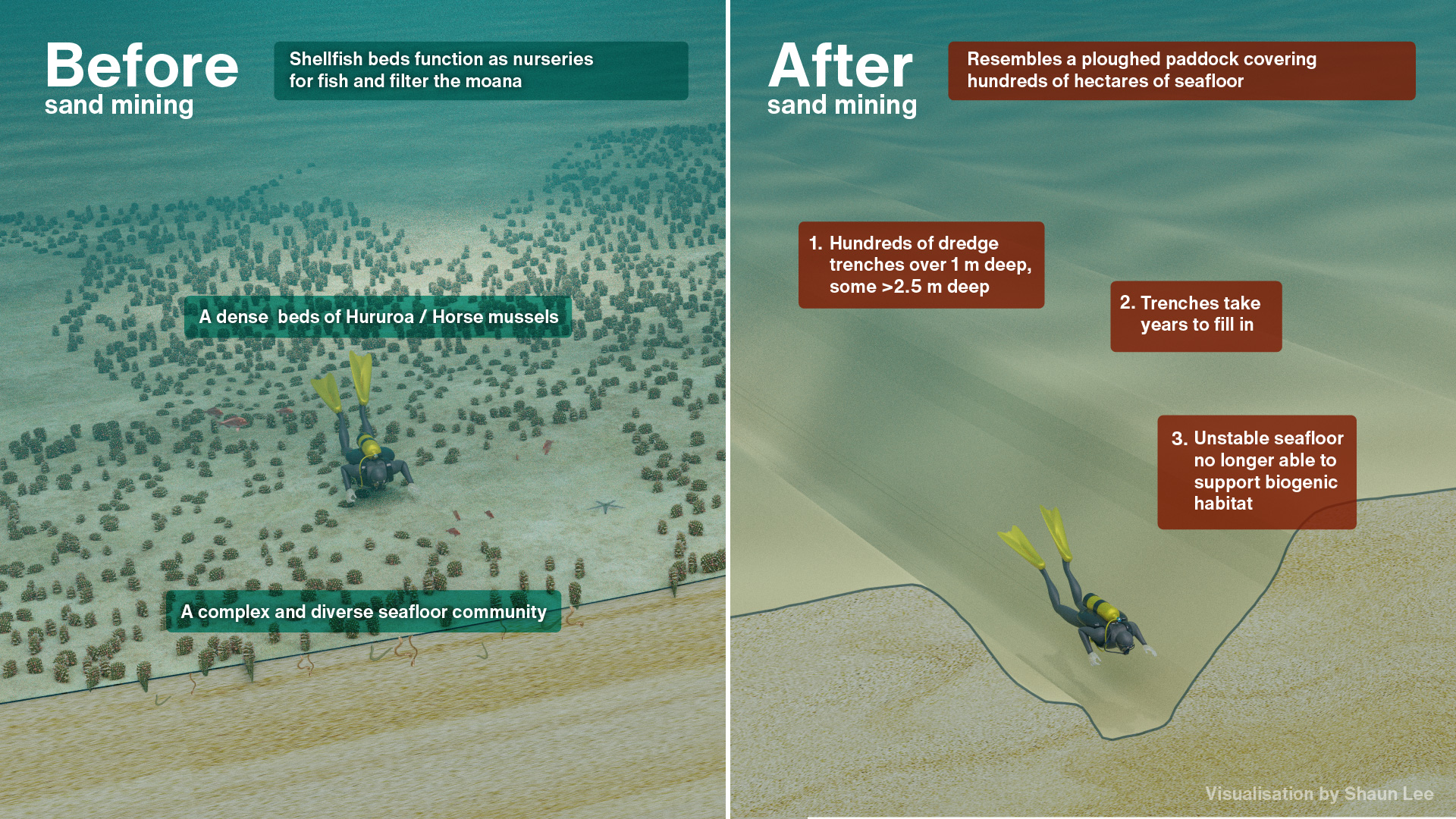
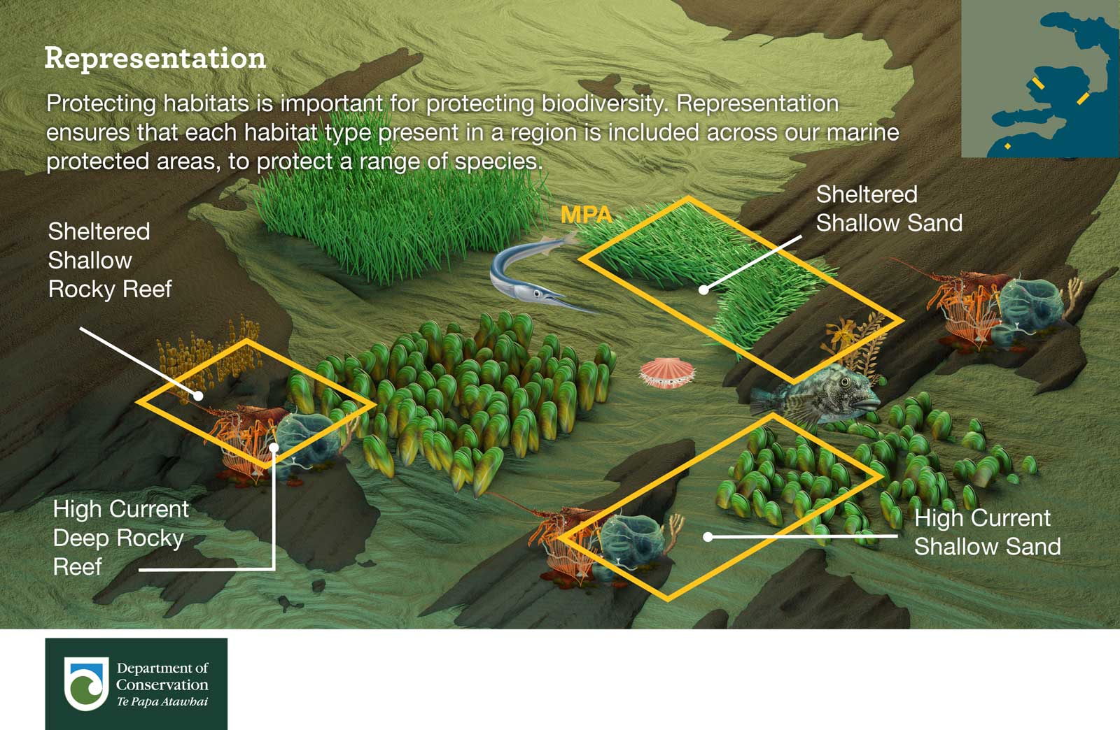
I have been helping hapu, iwi and community oppose massive sand mining consents in Pakari. I made this before and after graphic after reading the reports on the size of the trenches and seeing the lost biodiversity. It’s been used in this beautiful little video by Better Ancestors.
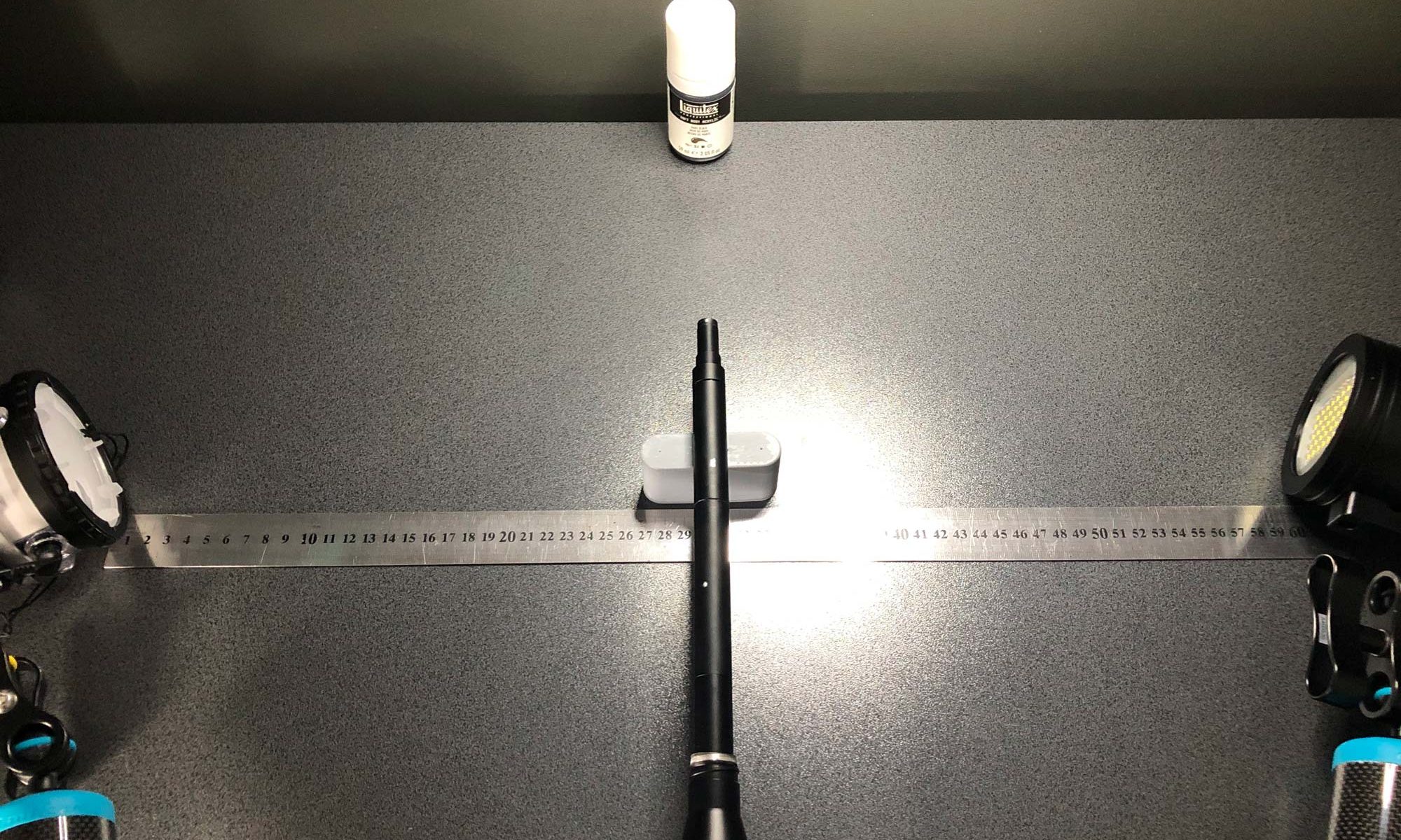
With video lights increasing in power some underwater photographers are wondering if they should skip the strobes and go for more expensive videos lights that deliver a WYSIWYG (what you see is what you get) photographic experience. Here I test a Sea & Sea YS-D3 II Strobe and a BigBlue 36000-Lumen Pro Video light. See testing setup photo above with lamp on which was turned off for the test. Settings: 1/250, F14, ISO 100 on an exposed and fogged up Laowa Probe Lens with no focusing light.
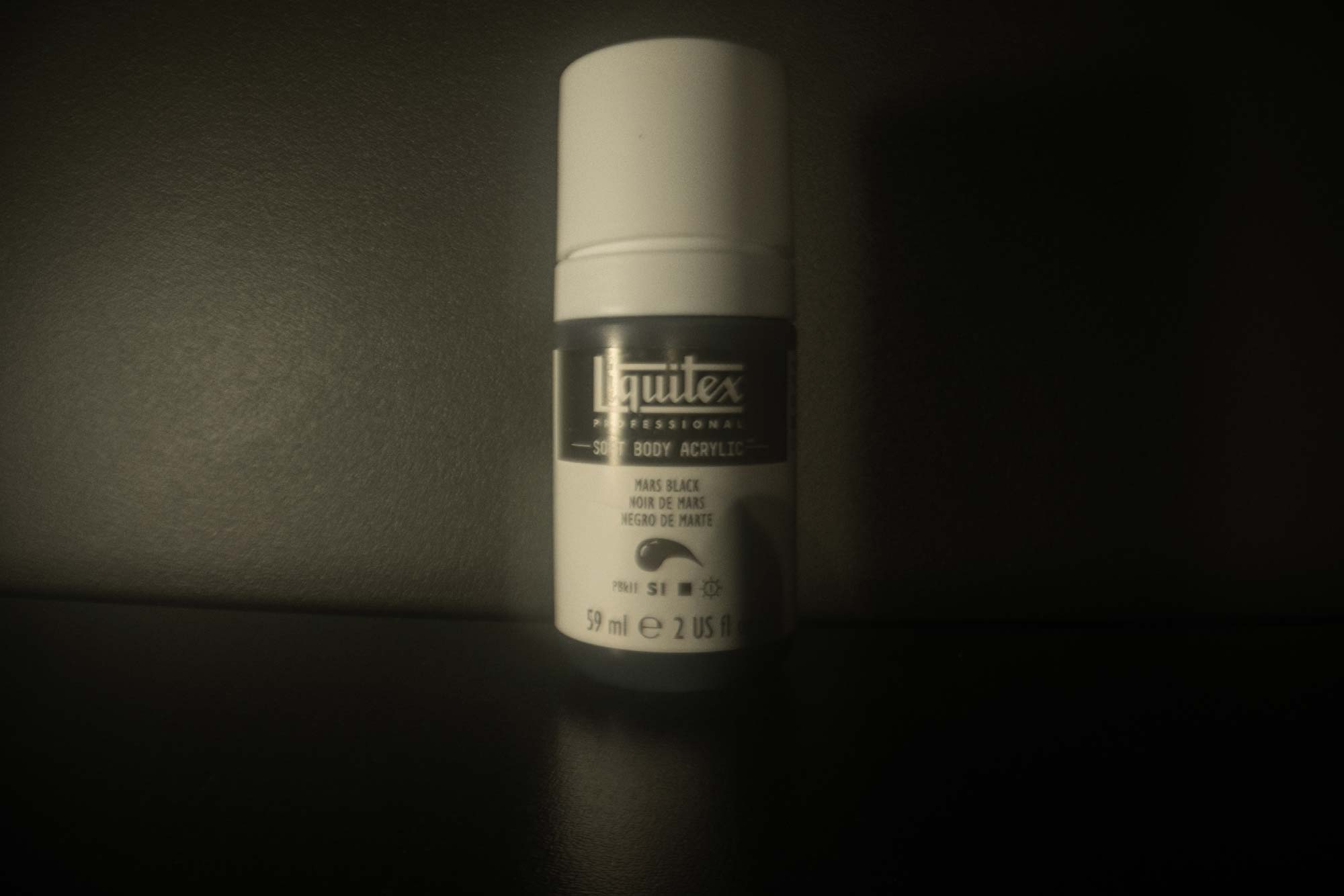

They seem to be about equal power which is interesting as I would have thought I would get more power from the strobe which has a guide number of 33. The difference in colour temperature is negligible with white balance set to auto (YS-D3 II Strobe = 5,800k, BigBlue 36000 = 6,500k).
I think its safe to call the YS-D3 II Strobe a 36,000 lumen light.

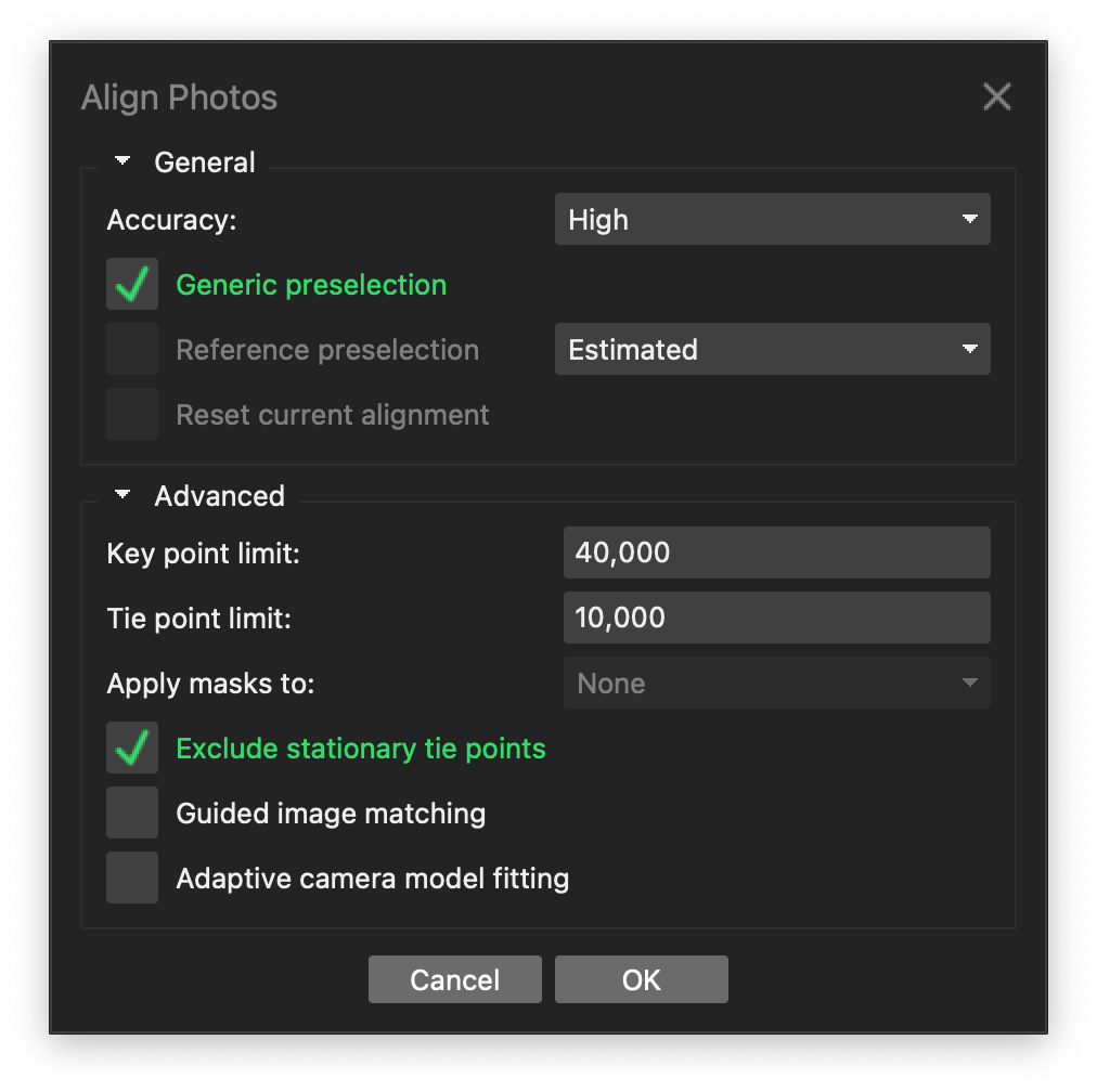
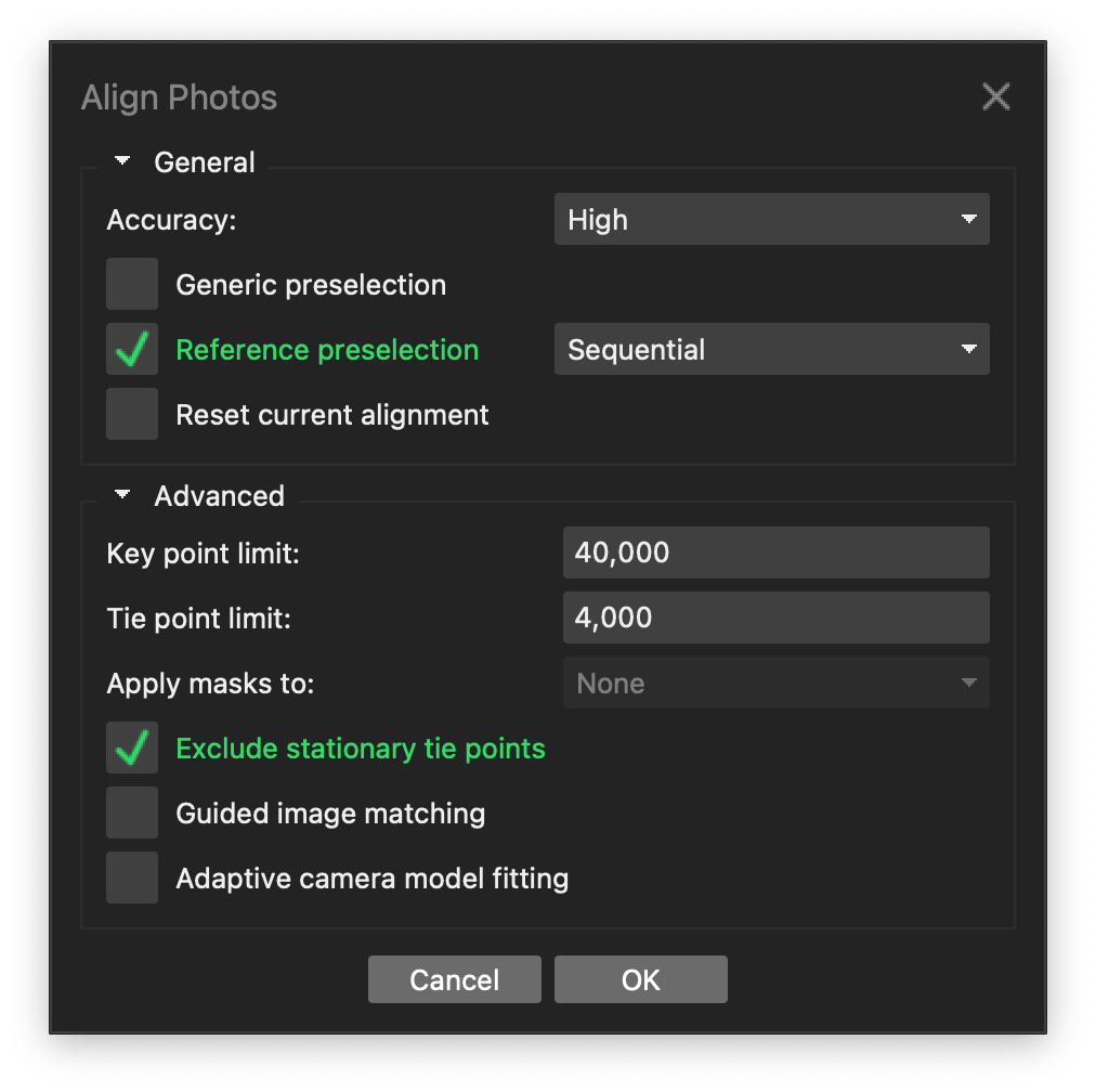
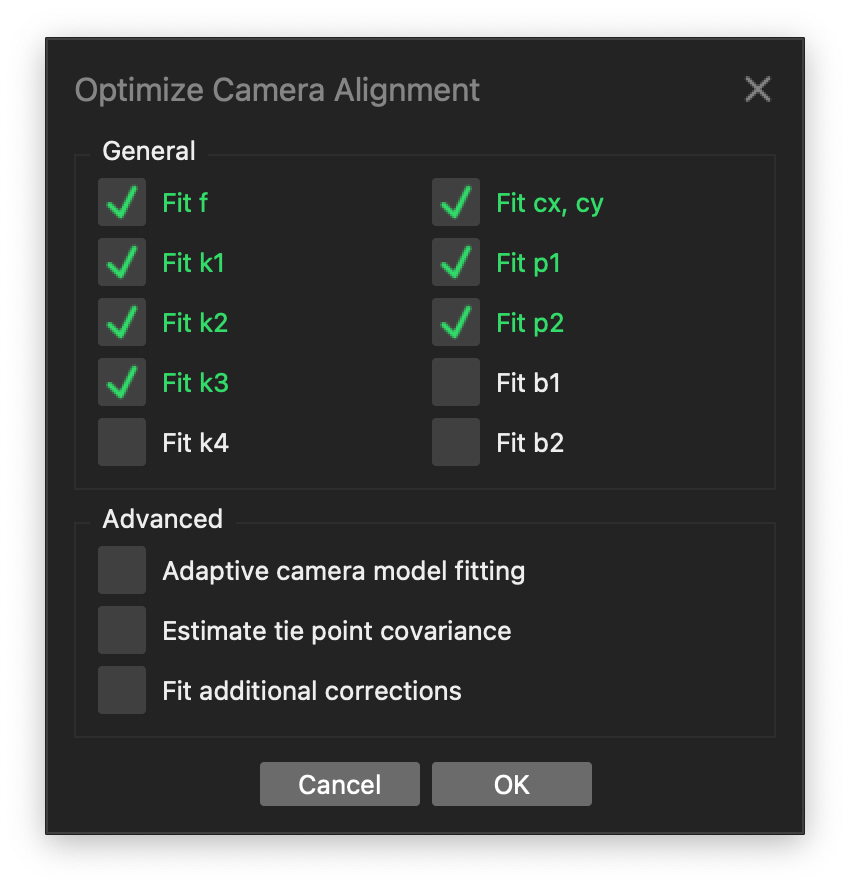
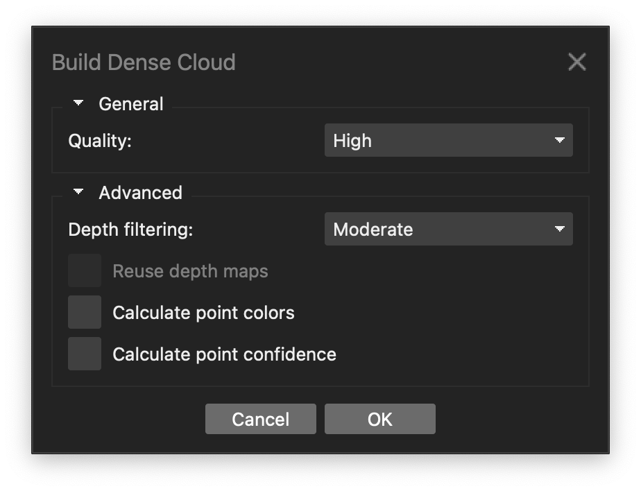
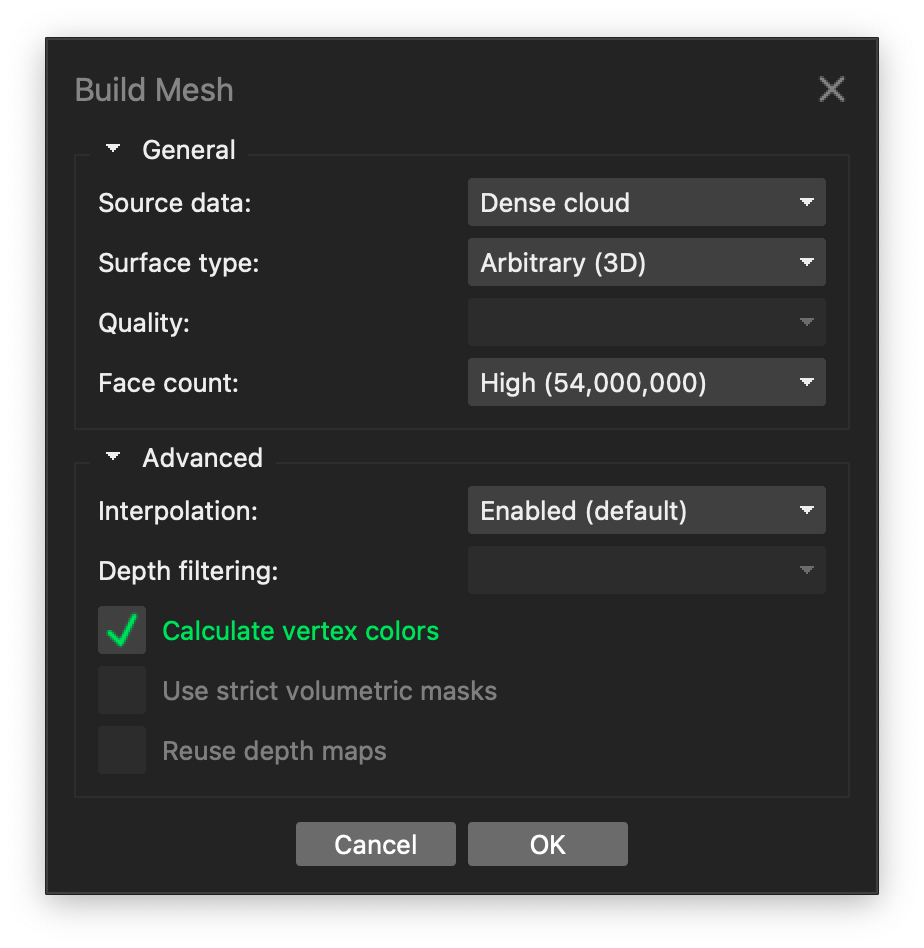
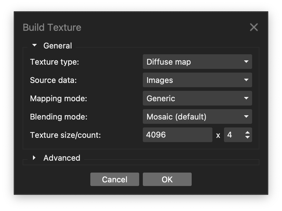
Here is a simplified version of my photogrammetry settings in Agisoft Metashape Standard 1.8.1 (mostly for my own reference). Detailed explanation here Mapping life on the seafloor/


The New Zealand Underwater Association’s (NZUA’s) Annual report is out with lots of stunning photos from Experiencing Marine Reserves. I do a lot of diving but I’m not a member of NZUA. One of the reasons for this is the associations close relationship with the blood sport organisations (New Zealand Sports Fishing Council / Legasea and The NZ Spearfishing Association).
Environmental campaigns are one of its three pillars but the organisations moral compass is compromised by support for activities that kill our native wildlife. They have been more political recently (lobbying government on fishing policy) but they aren’t developing their own views, just kowtowing to Legasea.
On page 26 of the Annual Report they have said they will be consulting on new Marine Protection Areas (MPAs) and that they support them, but they give some uninformed caveats.
We don’t support MPAs where:
1) An area is not of ecologically significant (This is the exact wording, not a typo from me)
This is an illogical statement because we need to protect a network of representative habitats from fishing. In Aotearoa / New Zealand less than a one percent of our marine environment is protected from fishing, so nearly any protected areas will become ecologically significant.
2) Where removing an area concentrates fishing effort elsewhere
All place based fishing protection displaces fishing effort, including those that limit commercial fishing. It’s a short term loss that is offset by the long term benefits of having an area with larger breeding animals which produce exponentially more offspring. For example it takes thirty six 30cm Tāmure / Snapper to make the same amount of eggs as one 70cm fish (Willis et. al., 2003). And of course the spillover effect which I should not have to explain.
Most divers and the New Zealand public understand this, which is why marine reserves are so popular. There is 77% support for 30% marine protection in the Hauraki Gulf Marine Park and 93% of the submissions for a recent marine reserve proposal for Waiheke Island were supportive, despite opposition from the blood sport lobby groups.
Despite our Marine Reserves being the best places to dive, NZUA say that ‘instead’ they will now support Special Marine Areas (SMAs). They then confuse the term as used in Revitalising the Gulf: Government action on the Sea Change Plan and tell readers that SMA’s include the mussel beds that I have been helping to make (which are not protected from human harvest), seaweed reestablishment and crayfish re-introduction. However these are all examples of active restoration – which I am a big fan of – but it’s really hard, small scale and expensive. Active restoration has its own work stream in the plan and is completely different to SMAs. In the Sea Change – Tai Timu Tai Pari marine spatial plan SMAs are Special Management Areas, they are described as “limiting all commercial fishing, and in addition the restrictions would extend to most recreational fishing (with the exception allowing for ‘low volume/high value’ catch)” They were proposed for the Mokohinau and Alderman Islands. Without strong limits on recreational fishing I expect the SMAs would have failed to create conservation outcomes in a similar fashion to Mimiwhangata. The experts have redesigned them as High Protection Areas (HPAs). The experts decided the SMAs (like Rāhui expressed as section 186 closures) are fisheries management tools rather than conservation tools. It will be interesting to see if DOC can get them to meet the International Union for Conservation of Nature’s (IUCN’s) high protections standards. Assuming these are the SMAs NZUA refer to, the SMAs would not have meet their own criteria (as an MPA that they are willing to support) because they would have displaced fishing effort.
By using the wrong terminology and examples, we can see NZUA have not paid much attention to the statements. The uninformed caveats for MPAs they would support show a general lack of awareness of ocean conservation. I hope they clarify their position. It sounds like NZUA and the blood sport groups will oppose the HPAs proposed in Revitalising the Gulf. This is disappointing, without more support NZ will stay in the 1% protection level along with Russia and China. See how marine protection in Aotearoa / New Zealand stands on the international stage in this awesome graphic by NZ Geographic.
NZUA are falling out of step with the New Zealand public and drifting away from their international counterparts who are strong ocean advocates. Divers have a unique view of the underwater world, I believe it comes with a responsibility to take care of it. I wish NZUA were more like PADI who are working to protect 30% of our oceans. SSI are also active in Aotearoa / New Zealand with a no harm Marine Conservation programme.
I hope NZUA one day learn to take the same precautionary care for the health of our oceans that they advocate for in diver safety.
An open letter to the Minister for Oceans and Fisheries.
Hon David Parker
Minister for Oceans and Fisheries
d.parker@ministers.govt.nz
11 May 2022
Tēnā koe Minister Parker
Pāpaka / Paddle Crabs (Ovalipes catharus) are native to New Zealand. There are 10 commercial fishery areas with nearly all the catch on the East coast of the North Island. The commercial catch has been in decline for two decades with no changes to the Total Allowable Commercial Catch (TACC). The TACC is about ten times larger than the recreational and customary catch. The main fisheries (PAD 1, 2, 3, 7, 8) look like they may have collapsed, the TACC for these fisheries total 590 tonnes, landings in the 2019-20 season were only 19.2 tonnes (3% of the TACC).
I disagree that the fishery is only lightly exploited (FNZ 2021).

Please research the current population. If you don’t have the resources to do this then I recommend you:
Thank you
References
FNZ 2021. PADDLE CRABS (PAD) https://fs.fish.govt.nz/Doc/25060/55%20PAD%202021.pdf.ashx
UPDATE 19 August
Response from Hon David Parker.
The response leaves catch limits incredibly high (765 tonnes for commercial) despite acknowledging that commercial take is incredibly low. The minister assumes that the population is healthy but provides no data to justify the decision.

I enjoyed making these Australian fairy tern replicas for the BirdLife Australia Fairy Tern project in Victoria. They will use them at events to help educate the community and raise awareness of the species to help their conservation.

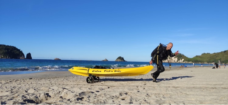
I figured out how to dive from my kayak this summer. It’s been really fun with lots of advantages including:

At first I tried towing my kayak to the water with my tank onboard. The C-Tug SandTrakz Cart Kayak Trolley is great but not designed to carry so much weight. Even without the tank I have broken one of the straps. I now carry my tank and BCD while towing the kayak with everything else onboard including my weights.

The other thing I find very useful is these stainless steel D-Eye Swivel Snap Hooks. The anchor, wheels and camera all get clipped on so nothing falls off. Even though I have clips for my paddle I tie it on as I really dont want my paddle gone when I resurface.
I found putting the BCD on in the kayak too hard so I just do that in the water, it has its own little rope & clip so it does not float away. I also 3D printed a fitting to get a little dive flag going but it should be bigger.
I love having more gear closer when shore diving, including my phone, dry keys and something warm to eat as soon as I get out of the water :D. I’m sure my set up will evolve over time (I need a slightly heavier anchor for soft substrates) but I’m really happy with this and plan to do lots more.
Extra photos by Kirk Tucker


Update August 2024

With the C-Tug Double Up Bar (four wheels!) I can now take everything down to the beach in one trip. I’m not quite strong enough to get it back up the steepest bit of sand in one trip and I take the dive tank back up separately.


