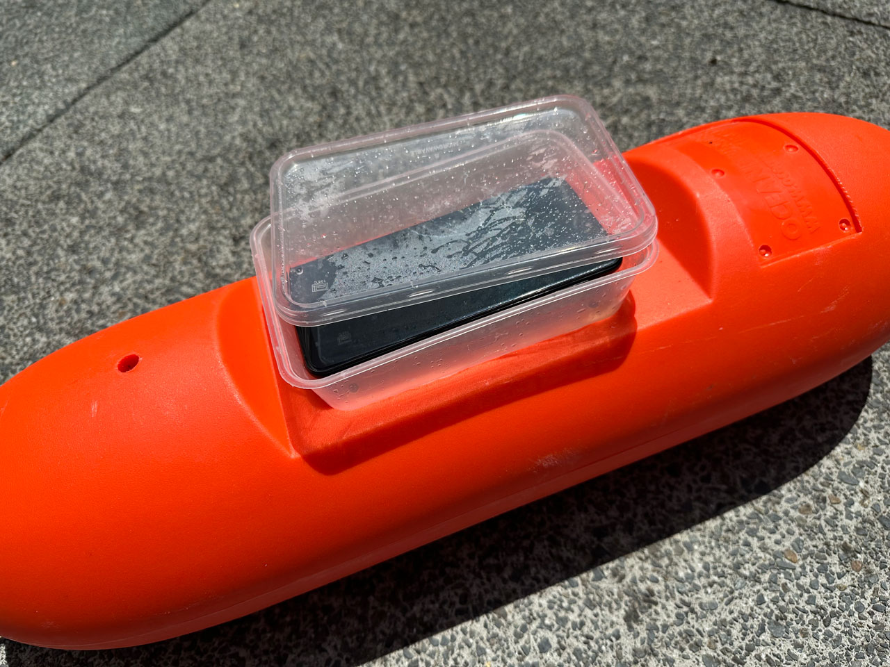
I was stoked to stumble across this kuakua shell drift North West of Waiheke Island. It adds a lot of complexity to the seafloor and is fun to explore because of the biodiversity it hosts. I imagined it was one large drift that I could map by attempting to swim around it at slack tide. To do this I dragged a float on the surface with my son’s phone attached. The phone was using MapMyRun as I am very familiar with the app. A plastic container was screwed to the float to hold the phone which was encased in two plastic bags, the lid of the container was also taped to the float). I had a friend on the surface follow me in a small boat with a Garmin Explorer Plus (this also helped with safety and was essential to help me get back to the boat against the current).

The bed is dominated by kuakua but also included large long trough shells (Oxyperas elongatum) and tipa / scallop shells further out. I used these large shells as the edge of the drift rather than the smaller shells. It was tempting to use the high contrast line created by dark red algae growing on undisturbed (but often smaller tawera spissa) shells which contrasted with the white shell hash. I took my phone to record marine life, logged on iNaturalist.nz. Many of the sponges were hard to identify as I was not using a dive light and the warm colours are missing.
The time stamps on my photos and the length of the dive on my dive computer were useful but the timestamps on the individual tracking points on the Garmin were essential to identify the dive path. This is because I needed to remove tracking points generated:
- Before the dive from boat movement
- While I drifted during my safety stop
- After the dive while being towed back to my boat
Although I ran out of air before I could get around the whole drift (44minute dive) the tracking data gives a sense for the size of the drift. By joining the start and endpoints the track roughly made a four sided shape for which I could calculate the area (16,813m2 or 0.017km2) by dividing it into two triangles and applying Heron’s Formula.
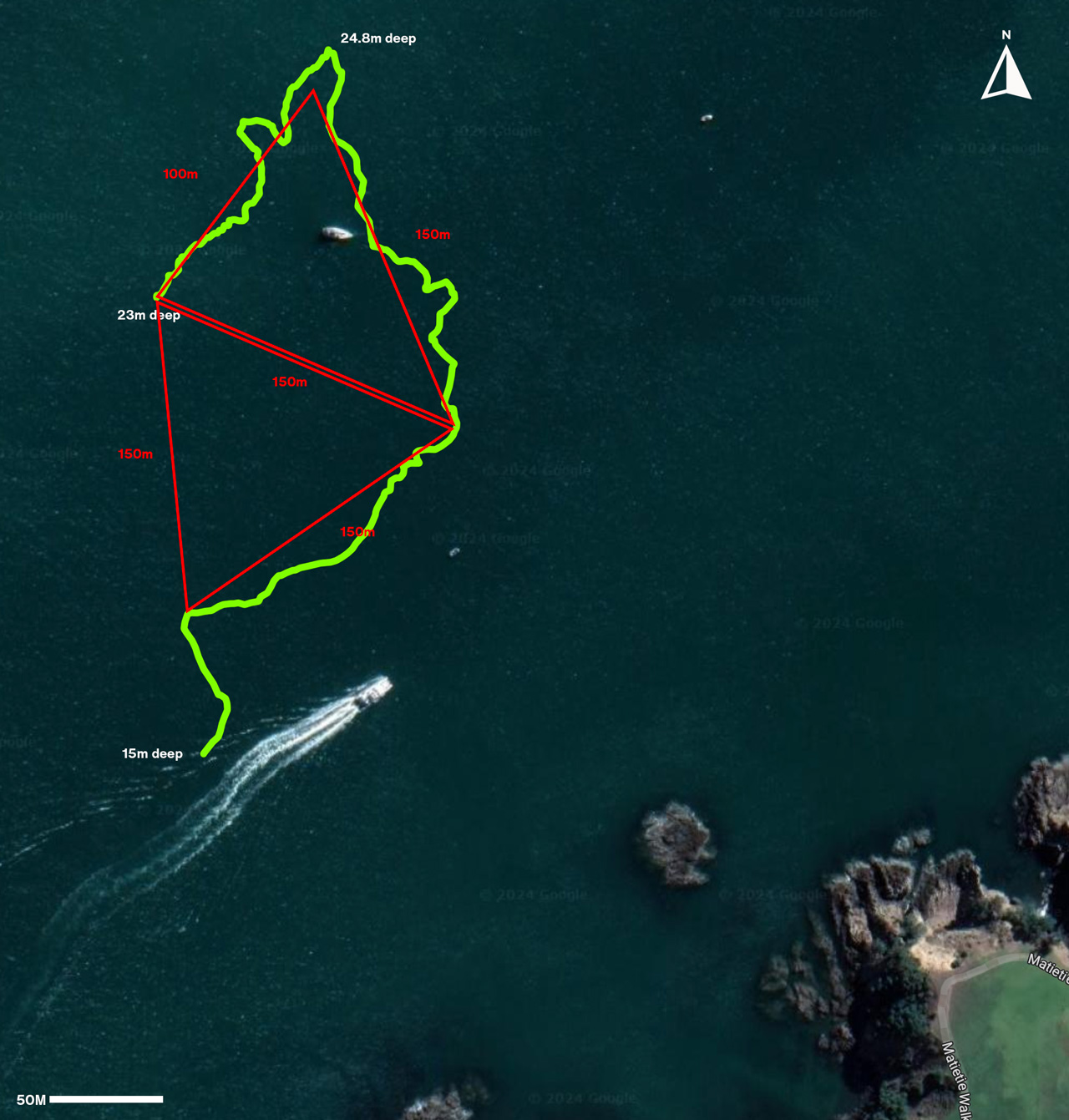
There were some small gaps in the drift and I’m sure the habitat exits outside the area I tried to circle, I felt like it was more dense in the NW where there was also more tipa shell. I’d like to make a little drop camera to get a better sense for the seafloor habitats surrounding the surveyed area. I would also like to try doing some photogrammetry showing the diversity in the drift , to do this I need to build a cage for my GoPro that I can attach lights to.


