In November I sent this letter to Auckland Councils Environment and Climate Change Committee along with this report. This morning I was invited to present to the Mayor of Auckland and the committee (presentation here) the report and letter were well received and I answered many questions from engaged Councillors. A response is being drafted.
Capture view (hide cameras and other visual aids first then export .PNG at a ridiculous resolution)
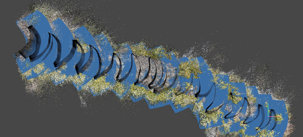
ArgiSoft Metashape worked much better than using Adobes photo stitching software (Photoshop & Lightroom) on the same data. But I need more overlapping images as all the software packages were not able to match all of any of the four test sequences I did.
I’m going to test shooting in video next. The frames will be smaller 2704×1520 (if I stick with linear to avoid extra processing for lens distortion) instead of 4000×3000 with the time-lapse but I’m hopping all the extra frames will more than compensate (2FPS=>24FPS).
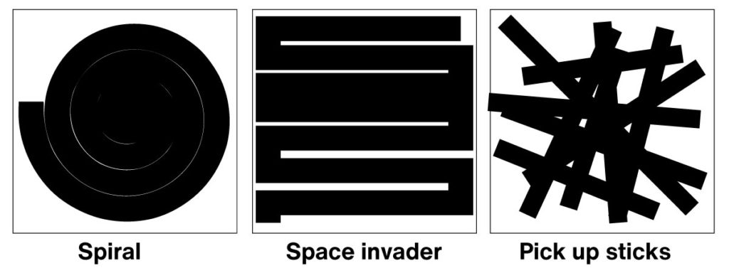
In theory an ROV will be better but I don’t think there are any on the market that know where they are based on what they can see. All the work arounds for knowing where you are underwater are expensive, here are two UWIS & Nimrod. I want to see if we can do this with divers and no location data. I don’t think towing a GPS will be accurate enough to match up the photos but it does seem to work with drones taking images of bigger scenes (I want this to work in 50cm visibility). I expect if I want large complete images the diver will need to follow another diver who has left a line on the seafloor. One advantage of this is that the line could have a scale on it, but I’m hoping to avoid it as the lines will be ugly 😀 So far I can do only two turns before it fails. There are three patterns that might work (Space invaders, Spirals and Pick up sticks). For my initial trials I am focusing on Space invaders.
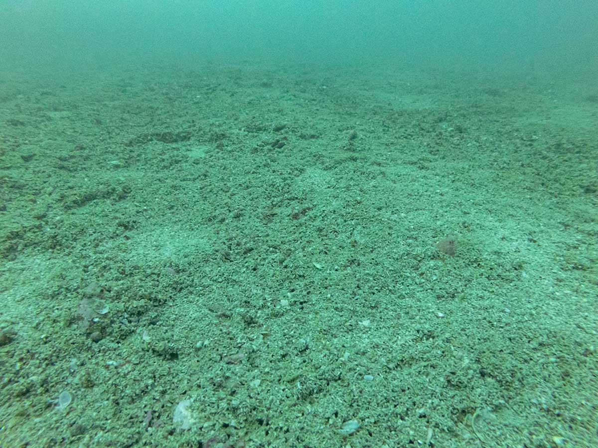
Video provides lots more frames and the conversion is easy. A land based test with GPS disabled, multiple turns, 2500 photos, 2704 x 2028 linear, space invader pattern at 1.2m from the ground worked perfectly. However I cant get it to work underwater. In every test so far Metashape will only align 50-100 frames. I tried shooting on a sunny day which was terrible as the reflection of the waves dancing on the seafloor confuses the software. But two follow up shoots also failed, when I look at the frames Metashape cant match I just don’t see why its can’t align them. Theses two images are in sequence, one gets aligned and the next one is dropped!
Here is what the test footage looks like, I have increased the contrast.
I have also tried exporting the frames at 8fps to see if the alignment errors are happening because the images are too similar but got similar results (faster).
Detailed advice from Metashape:
Since you are using Sequential pre-selection, you wouldn’t get matching points for the images from the different lines of “space invader” or “pick up sticks” scenarios or from different radius of “spiral” scenario.
If you are using “space invader” scenario and have hundreds or thousands of images, it may be reasonable to align the data in two iterations: with sequential preselection and then with estimated preselection, providing that most of the cameras are properly aligned.
As for the mesh reconstruction – using Sparse Cloud source would give you very rough model, so you may consider building the model from the depth maps with medium/high quality in Arbitrary mode. As for the texture reconstruction, I can suggest to generate it in Generic mode and then in the model view switch the view from Perspective to Orthographic, then orient the viewpoint in the desired way and use Capture View option get a kind of planar orthomosaic projection for your model.
Align ‘sequential’ only ever gets about 5% of the shots. Repeating the alignment procedure on ‘estimated’ picks up the rest but the camera alignment gets curved. I think I have calibrated the cameras to 24mm (it’s hard to see if that has been applied) but it doesn’t seem to change things.
I tried an above water test and made a two minute video of the Māori fish dams at Tahuna Torea. I used the same settings as above, but dropped the quality down to medium. It looks great!
The differences between above and below water are: Camera distance to subject, flotsam, visibility / image quality and colour range. If the footage I am gathering is too poor for Metashape to align it might mean we need less suspended sediment in the water to make the images. That’s a problem as the places I want to map are suffering from suspended sediment – which is why they would benefit from shellfish restoration.
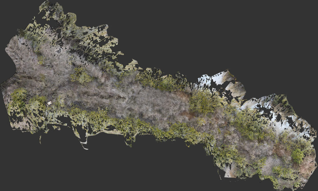
The Agisoft support team are awesome. They processed my footage with f = 1906 in the camera calibration, align photos without using preselection and a 10,00 tie point limit. The alignment took 2.5 days but worked perfectly (click on the image below). There are a few glitches but I think the result is good enough for mapping life on the seafloor. I will refine the numbers a bit and post them in a seperate blog post, wahoo!
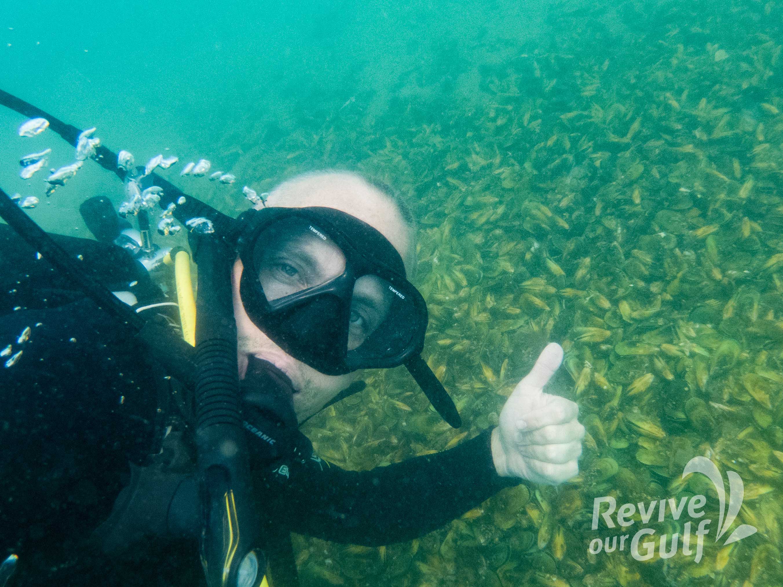
Here is my photogrammetry process / settings for GoPro underwater. I am updating them as I learn more. Please let me know if you discover an improvement. Thanks to Vanessa Maitland for her help refining the process.
Here is an example image made using the process, the area is about 8m in diameter, click on the image to see it full size.
Step 1: Make a video of the seafloor using a GoPro
If you’re at less than 5m deep you will need to go on a cloudy day for even light
Make sure you shoot 4k, Linear. Also make sure the orientation is locked in preferences.
Record you location and the direction your going to swim if you want to put your orthomosaic on a map
Swim in a spiral using a line attached to a peg to keep the distance from it even
Don’t leave any gaps or you will generate a spherical image
Step 2: Edit your video
There are lots of software packages that will do this, I use Adobe After FX where I can increase the contrast in the footage and add more red light depending on the depth. You might also find it easier to trim your video here but you can also do it in Step 5.
Step 3: Install and launch Agisoft Metashape Standard.
These instructions are for version 1.8.1
Step 4: Use GPU.
In ‘Preferences’, ‘GPU’ select your GPU if you have one, I also checked ‘Use CPU when performing accelerated processing’
Step 5: Import video
From the menu chose: ‘File’, ‘Import’, ‘Import Video’.
The main setting to play with here is the ‘Frame Step’ We have had success with using every third frame which cuts down on processing time.
If you have multiple videos you will have to import multiple chunks, then I recommend combining them before processing using ‘Workflow, Merge Chunks’, I have had better results doing this, rather than processing each chunk individually then choosing ‘Workflow, Align Chunks’.
Step 6: Camera calibration
From the menu chose: ‘Tools’, ‘Camera calibration’
Change ‘Type’ from ‘Auto’ to ‘Precalibrated’
Change the ‘f’ value to 1906
Step 7: Align photos
From the menu chose: ‘Workflow’, ‘Align Photos’
Check ‘Generic preselection’
Uncheck ‘Reference preselection’
Uncheck ‘Reset current alignment’
Select ‘High’ & ‘Estimated’ from the dropdown boxes Under ‘Advanced’ chose:
‘Key point limit’ value to 40,000
‘Tie point limit’ value to 10,000
Uncheck ‘Guided image matching’ & ‘Adaptive camera model fitting’
Leave ‘Exclude stationary tie points’ checked
If 100% of cameras are not aligned then try Step 8 otherwise skip to Step 9.
Step 8: Align photos (again)
From the menu chose: ‘Workflow’, ‘Align Photos’
Uncheck ‘Generic preselection’
Check ‘Reference preselection’
Uncheck ‘Reset current alignment’
Select ‘High’ & ‘Sequential’ from the dropdown boxes Under ‘Advanced’ chose:
‘Key point limit’ value to 40,000
‘Tie point limit’ value to 4,000
Uncheck ‘Guided image matching’ & ‘Adaptive camera model fitting’
Leave ‘Exclude stationary tie points’ checked
Now all the photos should be aligned, if not repeat step 7 & 8 with higher settings and check ‘Reset current alignment’ on step 7 only. I have been happy with models that have 10% of photos not aligned.
Step 9: Tools / Optimize Camera Locations
Just check the check boxes below (default settings):
Fit f, Fit k1, Fit k2, Fit k3
Fit cx, cy, Fit p1, Fit p2
Leave the other checkboxes (including Advanced settings) unchecked.
Step 10: Resize region Use the region editing tools in the graphical menu make sure that the region covers all the photos you want to turn into a 3D mesh. You can change what is being displayed in the viewport under ‘Model’, ‘Show/Hide Items’.
Step 11: Build dense cloud
Quality ‘High’
Depth filtering ‘Moderate’
Uncheck all other boxes.
Step 12: Build mesh
From the menu choose: ‘Workflow’, ‘Build Mesh’
Select ‘Dense cloud’, ‘Arbitrary’
Select ‘Face count’ ‘High’
Under ‘Advanced’ leave ‘Interpolation’ ‘Enabled’
Leave ‘Calculate vertex colours’ checked
Step 13: Build texture
From the menu choose: ‘Workflow’, ‘Build Texture’
Select ‘Diffuse map’, ‘Images’, ‘Generic, ‘Mosaic (default)’ from the dropdown menus.
The texture size should be edited to suit your output requirements. The default is ‘4096 x 1’
Under ‘Advanced’ Turn off ‘Enable hole filling’ & ‘Enable ghosting filter’ if you’re using the image for scientific rather than advocacy reasons.
Step 14: Export orthomosaic You can orientate the view using the tools in the graphical menu. Make sure the view is in orthographic before you export the image (5 on the keypad). Then chose ‘View’, ‘Capture View’ from the menu. The maximum pixel dimensions are 16,384 x 16,384. Alternatively you can export the texture.
==
Let me know if you have experimented converting timelaspe / hyperlapse video to photogrammetry. There may be some advantages.
As communities get increasingly worried about the declining quality of their waterways there is more interest stream health assessments. I am a huge fan of the Waicare Invertebrate Monitoring Protocol (WIMP) which is simple enough that school students can use it. However the Waicare programme has been largely defunded by Auckland Council and there is no way for the public to share WIMP data. NIWA and Federated Farmers of New Zealand have put together https://nzwatercitizens.co.nz/ based on the New Zealand Stream Health Monitoring and Assessment Kit (SHMAK). It is great but incredibly hard to use, the manual is horrific. I believe this is being addressed but will take years. To help, the science learning hub has made this great guide for teachers and students. NIWA have put together some videos. They are not published together anywhere online so I have posted the list below:
I really like this list of alternative words for environmental terms, offered by George Monbiot & Ralph Steadman. I have rebuilt it in HTML with some additions and deletions, I plan to evolve it over time.
Existing terms
What’s wrong with it
Alternative terms
Environment
Cold, technical Seen as seperate
The natural world
Global warming
Warm sounds pleasant
Global overheating
Biodiversity
Inaccessible
Wildlife
Ecosystem services
Anthropocentric and reductive
Life support systems
Nature reserve
‘reserve’ suggests coldness
Wildlife refuge
Habitat destruction Deforestation Biodiversity loss
Sounds like they are happening to themselves
Ecocide
Conservation
Preserving what little is left rather than rebuilding living systems (New Zealand needs a department of Restoration)
Restoration
Clean rivers / seas
Sounds too hygienic, is blind to waters as habitats
Thriving rivers / seas
Fossil fuels
Suggests redundancy
Dirty fuels
Sustainable development
Green growth is an oxymoron
Regenerative development
Photopollution
Too technical, doesn’t indicate what is being impacted
Ecological light pollution
Stormwater
Suggests that the water is unwanted, unnecessary or unsavoury
Rainwater
MARINE
Fish stocks
Suggests fish are here to serve us
Wild fish populations
Biofoul, foul, foul ground
Suggests there is something ugly about biogenic habitats
Sea life, seafloor life, benthic epifauna
Fishing
Casual everyday activity
Killing native wildlife
Bait fish
Implies the fish exist to be bait
Small schooling fish / forage fish / small pelagic fish / shoaling fish
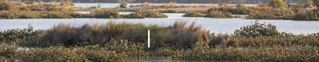
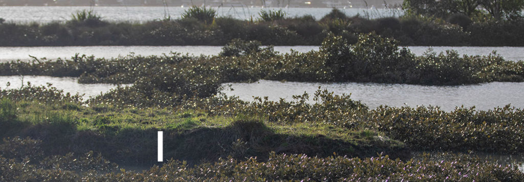
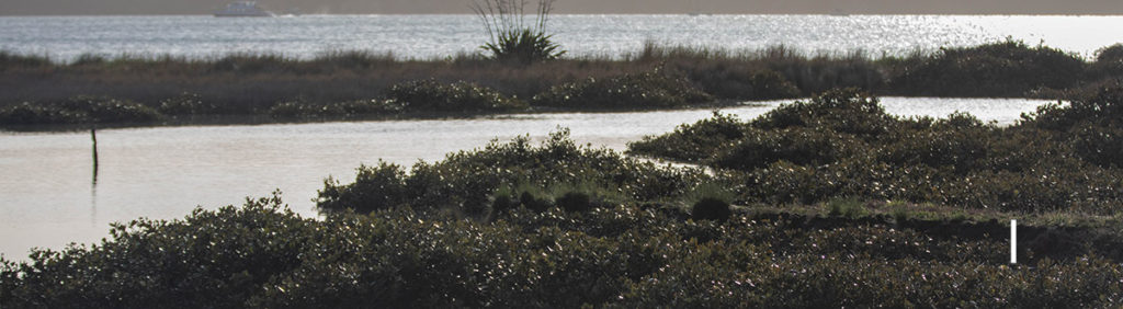
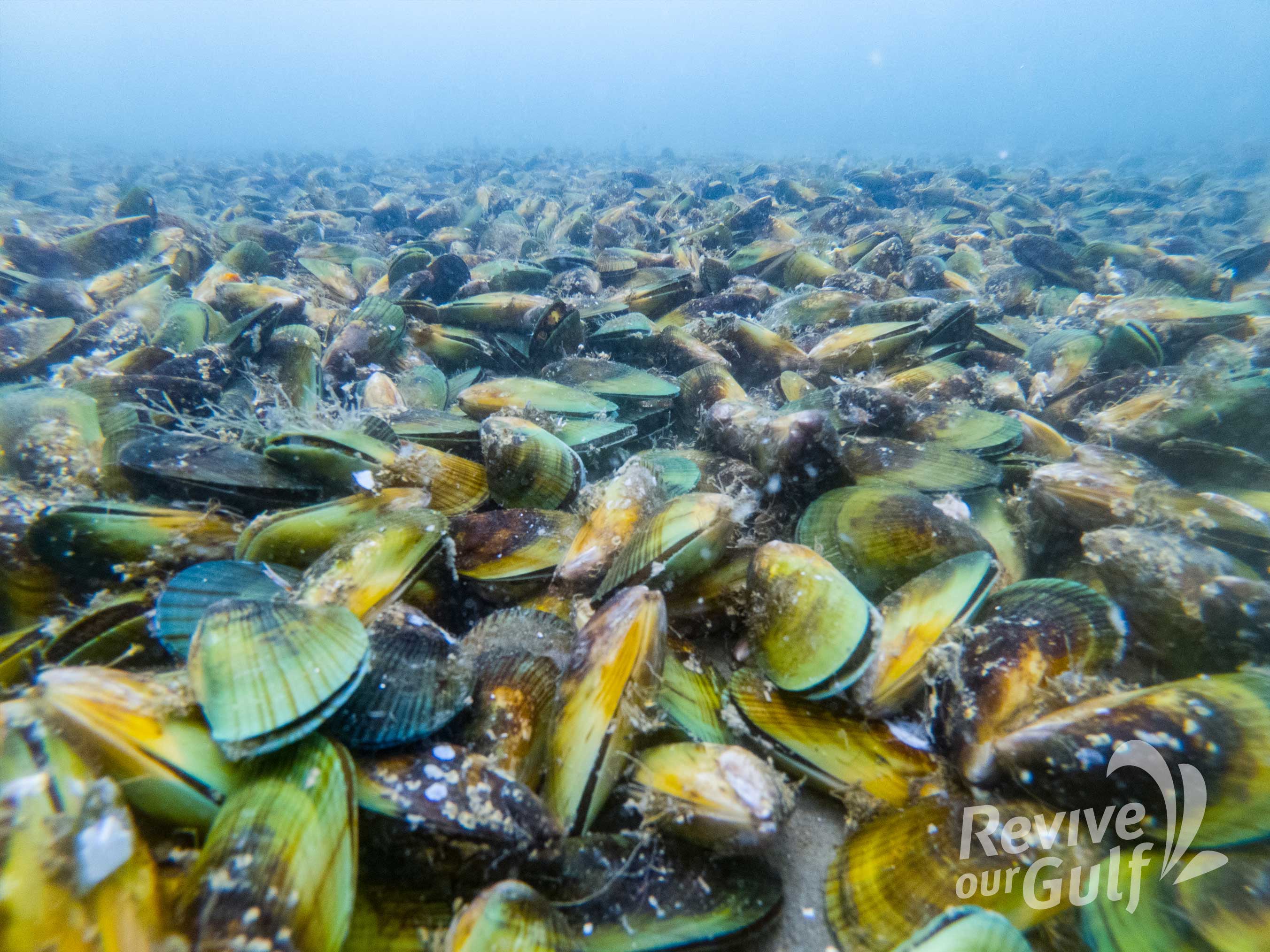
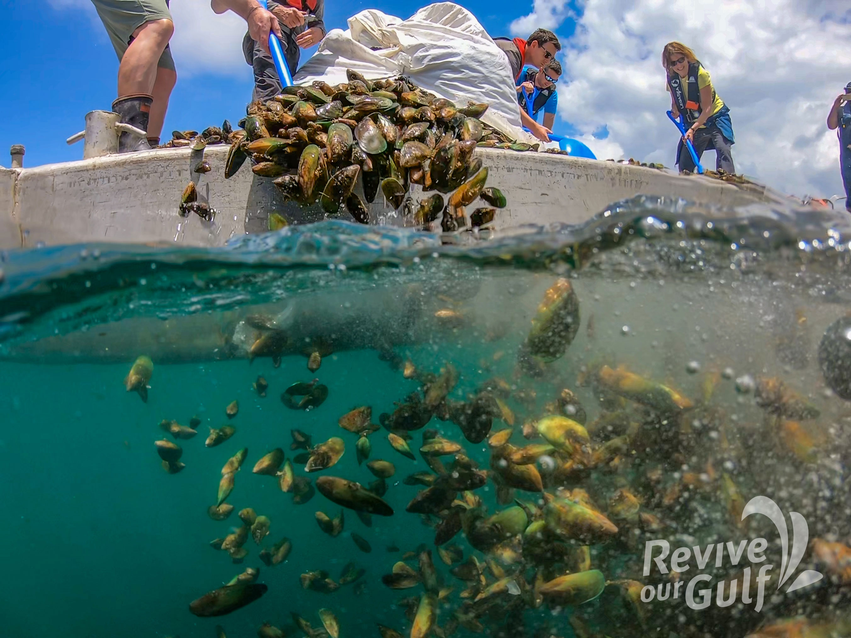
Marine restoration is a lazy business. All you have to do is stop fishing an area and marine ecosystems heal themselves. However this is not the case with green-lipped mussels in New Zealand.
100’s of square kilometres of sub-tidal mussel beds were fished to extinction in each harbour around New Zealand.
The industry collapsed and more than half a century later they have not returned. In the Hauraki Gulf there are a few places you can still find Green-lipped mussels. You would think that these places would be deep under the ocean (Green-lipped mussels have been found at 50m deep), but they are not.
Most are in the intertidal zone on rocky shores. Here there is usually a gradient with mussels thin higher up and getting thicker towards the low tide mark where the abruptly stop. I have asked several local experts and no one has a solid answer why they stop so abruptly.
As we spend 100’s of thousands of dollars restoring sub-tidal beds maybe the key to unlocking a lazier (and cheaper) solution is staring us in the face. Here are some thoughts on why the line exists:
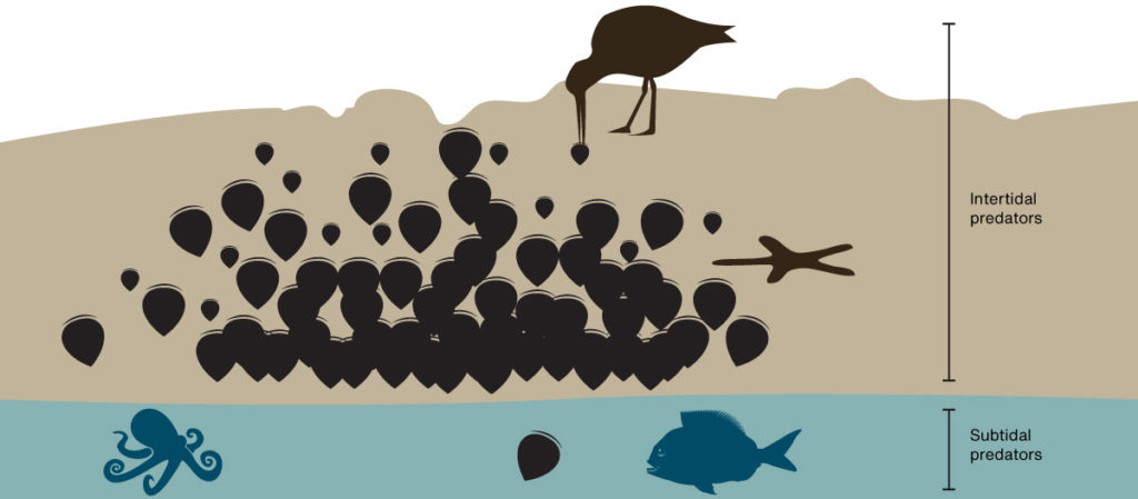
Avian predation. Every exposed mussel bed has at least one pair of Variable oystercatcher eating the smaller mussels every low tide. So living in the subtidal zone would be of some advantage but we are more likely to see juveniles higher up. This suggests there is even more predation from below.
Starfish predation. Eleven-armed star fish were a big problem in the first beds put down by Revive our Gulf. However starfish do okay in the intertidal zone and are not particularly abundant in intertidal beds. We don’t see lots of them waiting below the low tide mark next to intertidal mussel reefs.
Fish predation. This seems like the most obvious cause but surely it can’t be Snapper as they have been fished down to 20% of their natural biomass. Rays are a possibility but I thought I would see more of them in the shallows if this was the case. This southern study looked at predation and found it to be largely subtidal and nocturnal, by fish and large crabs.
Octopus predation. They are nearly invisible and love eating mussels so at first this is a good fit. But octopus leave the shells, I will look for evidence on the next intertidal bed I explore. None of the predation theories show why the line is so strong.
Food. Mussels eat phytoplankton and algae. I am sure there will be more of this close to the surface. I am pretty sure this is why mussel farmers grow their mussels high in the water column. Wild mussels might also benefit from wave action on the rocks as it would increase the oxygen in the water. However I would have thought that these benefits would be offset by the fact they can’t feed while they are exposed to the air.
Sediment. If there is some other benefit to being exposed to the air maybe it’s that the water in the Gulf just has too much stuff in it. Mussels have to work hard sorting out the food from the dirt, maybe mussels are not good at taking a break and being forced to is good for them. Comparing the condition of intertidal and sub-tidal mussels would help dismiss this idea.
Or maybe like a lot of things in biology it’s a mixture of the above factors. As we are slowly losing our intertidal mussel beds it might be wise to set up a long-term monitoring project that might solve this mystery and inspire lazier restoration methods.
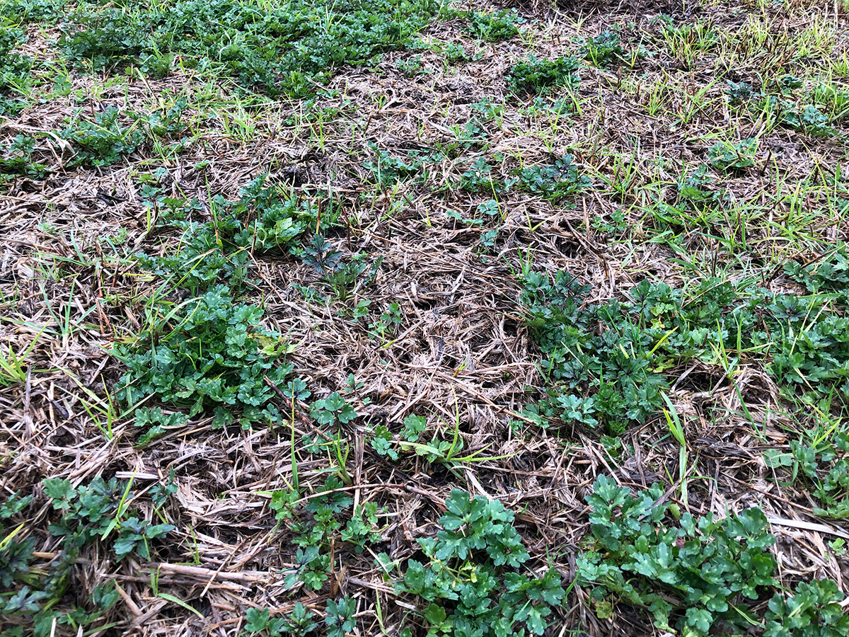
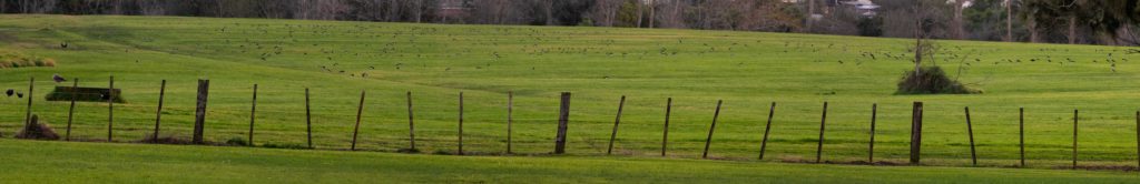
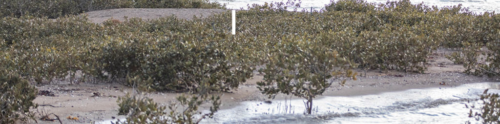
With a lot more mowing at Point England this Winter the flocks of South Island pied oystercatcher are leaving a visible sign in the paddock. The probe holes are very dense right to the edges of the paddocks which means that I am also seeing holes from other species like White-faced heron and Pukeko. Casual counts put the number of little holes at around 100 per square meter.
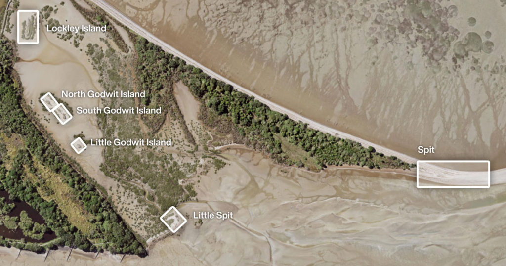
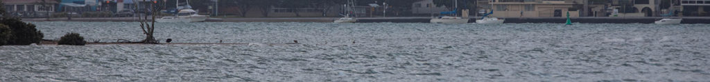
Today I took photos of the shorebird roosts at Tahuna Torea when the tide had just covered the main spit roost. The tide height was predicted to be very high today (3 August 2019) at 3.4M Westhaven 8:53am. Conditions were relatively calm and the tide had not (yet) hit the high tide line on the Little spit.
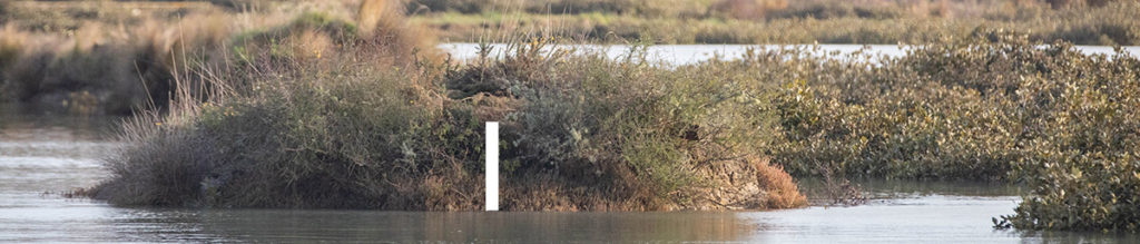
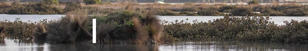
Names and locations of roostsThe tide was about 20cm (in height) from the high tide line.And the pathway which is sometimes flooded was about 20cm above the water.The spit had just been compromised with just a few Black-back gulls and one Caspian tern remainingLittle spit was about 50cm above the tideLittle Godwit Island was about 60cm above the tideSouth Godwit Island was about 75cm above the tideNorth Godwit Island had about 40cm above the tideThe Southern end of Lockley Island had about 40cm above the tideThe Northern end of Lockley Island had about 40cm above the tide
I have seen tidal debris in the mangroves around Lockley Island that were above the height of the island (indicating that it sometimes gets swamped) but I think it would have made an ok roost today.
I presented this report to the Maungakiekie-Tāmaki Local Board today as they are yet to seek advice from a shorebird expert at Auckland Council in developing their Open Space Network Plan (OSNP).
It recommends:
Shorebird expert to review the report.
Local Boards commit to reverse declining shorebird numbers.
OSNP revised with dedicated and enhanced shorebird roosts.
Serious investments in shorebird roost protection and enhancement.
I have also attached my amendments to the OSNP and my submission on the OSNP above.
UPDATE: 18 June 2019 Great article on the report by Farrah Hancock here
UPDATE: 12 July 2019 “The report’s recommendations accord closely with the Council’s policies and objectives to protect biodiversity in the Auckland region.” – Dr Tim Lovegrove
The MTLB have made changes to the OSNP as follows:
Page/title
Amended text
Page 10 (Coastlines and Waterways)
The Tāmaki Estuary is home to a varied number of shorebird species. The shorebirds roost in the reserves along the coastal edge throughout the year including Point England Reserve, Wellington War Memorial Reserve and Tahuna Torea Nature Reserve.
Several species are threatened and the populations are in decline.
Threats to the shorebirds include disturbance of their roosts preventing them from resting, particularly at high tide, from lighting of the reserves at night, dogs, humans, unsuitable vegetation and construction.
Page 20 (Environmental Quality)
+ Shorebird populations are in decline due to their roosts within the coastal reserves being disturbed
Page 36 (Improve biodiversity and water quality)
Protect and enhance shorebird roosting areas:
+ Investigate opportunities to restore roosting areas for shorebird populations
+ Provide opportunities to protect existing roosting areas.
The wording is well chosen and at a high level it addresses my core concerns. A good start to reversing the decline of the shorebirds in the Tāmaki Estuary.
UPDATE: 7 May 2020 The authors have really taken on board the feedback! Shorebirds (which contain the most conservation dependant species in the region) were excluded from the plan. They now feature on pages 10, 21, 37, 51, 52, 55, 93, 94, 109. You can download the finalised copy of the Tāmaki Open Space Network Plan here. [Published here first!]
UPDATE: 20 August 2020 Ōrākei Local Board’s environment work programme 2020/2021: Tāhuna Tōrea investigation of habitat restoration for shorebird roosting $15,000
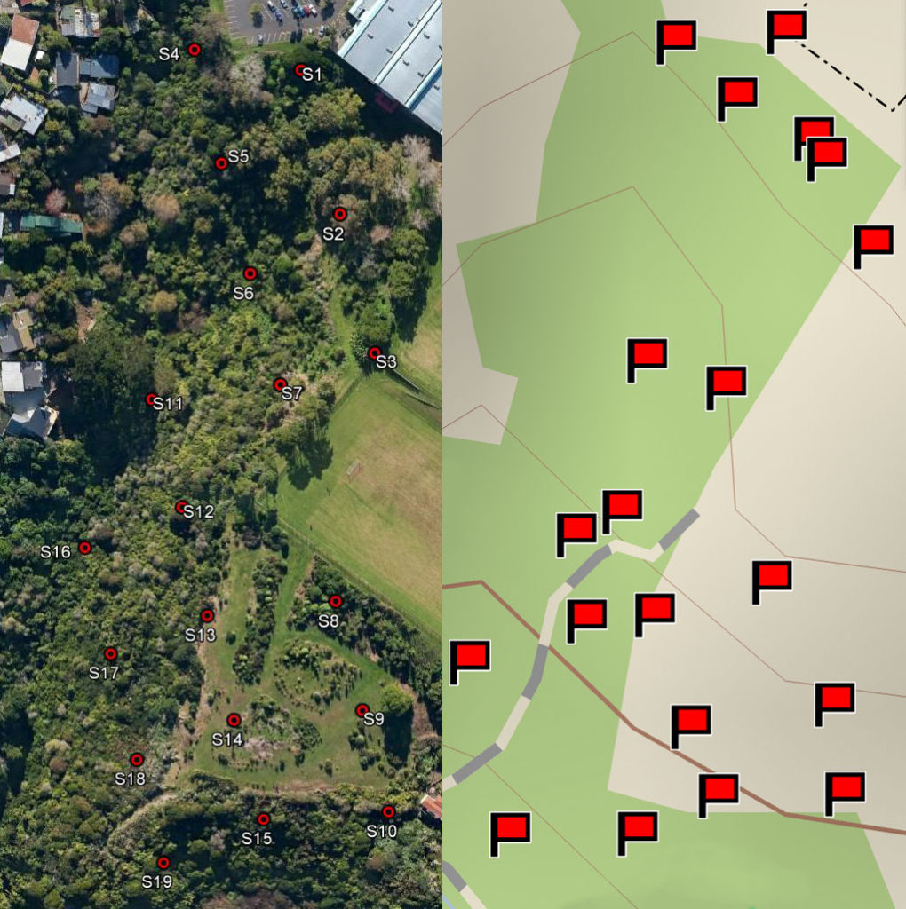
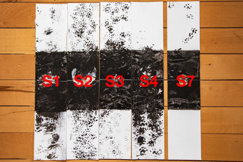
We identified 19 tracking locations (S1-S19) in 2014. The first 10 (S1-S10) were used in this survey. The survey was repeated in March 2019. The first 10 locations were searched and three out of 10 tracking tunnels were found. Seven new tracking tunnels were installed on the 10th of March. On the 16th of March another 9 tunnels were installed and all the tunnels were filled with an inked tracking card with peanut butter in the middle. Some locations were adjusted to make access easier. I noticed when trying to find the tunnels again with the Garmin InReach and App that the positions were often off by up to 16M. Thats a lot in the bush!
Locations of the 2014 tracking locations compared to the actual locations of the tunnels placed in 2019.
RESULTS
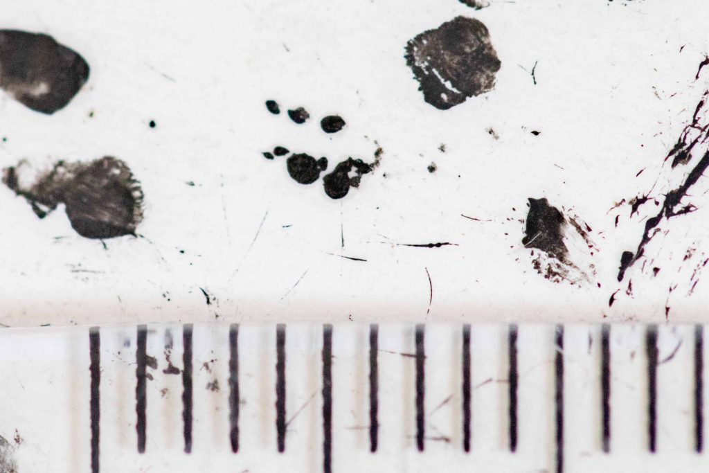
I find these mashed up prints very hard to identify, but here is my best guess:
WW = Winged weta, I was particularly looking for this species. See my blog post on tracking winged weta here.
Suspected winged weta tarsal pad print
I think we should probably ignore the tracking tunnels put out recently (S11-S19) as they may have been avoided due to (at at least some of) the target species being neophobic.
This would give us a result for 2019 of 20% Rat, 0% Mice, 50% Hedgehog. This indicates we have less rats & mice and more hedgehogs than 2019.
I have left the tunnels out there, it might be a good idea to retry in a few weeks. It’s interesting that we see more pests near the top of the bush, this has been observed before.
I think this is the worlds first photo of a freshly planted mussel bed. Altho I have been to most of Revive our Gulf’s deployments (including the first one in 2013) we have’t dived on them straight away. After taking this photo I deployed three time-lapse cameras to record suspected predation (I was happy to discover none). I also photographed a nearby bed that was laid a week ago where the mussels are standing up and had knitted together. It would be interesting to know how long it takes them to jostle into position.