I don’t know how to solve this problem, so I am writing it up as a public brief for people smarter than me.
Brief for restoring extremely degraded seafloor ecosystems
Soft sediment marine ecosystems support diverse and productive biogenic habitats like shellfish beds, sponge gardens, tubeworm fields, and bryozoan mounds. Direct impacts such as mobile bottom contact fishing, and indirect impacts such as sediment pollution, reduce the function of these habitats. Stopping or reducing the impacting activities can help the habitats recover naturally over many decades. Active restoration (like mussel and oyster seeding) can be done in areas where the habitat is not recovering naturally; however, some environments can be too degraded for these methods.
Problem
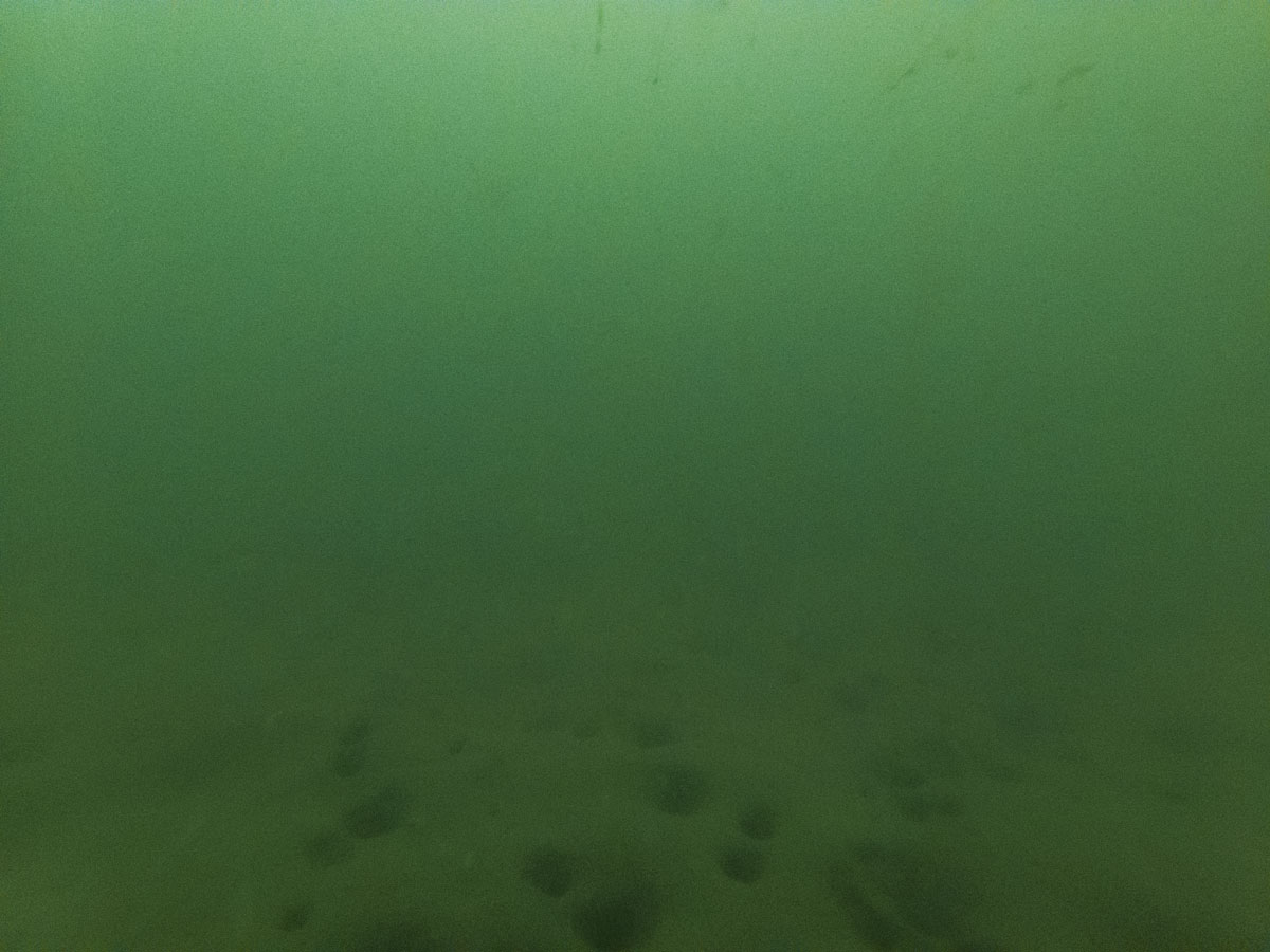
In my opinion, at least tens of square kilometres of the Hauraki Gulf Marine Park are too degraded to restore with known techniques. In these extremely degraded areas, the seafloor is very soft, deep mud. It’s not lifeless; there are burrows and infauna present. But the areas would be more diverse and productive if the seafloor was less soft with less sediment in suspension. Even when pollution input has been reduced in these extremely degraded areas, legacy sediment is constantly resuspended – choking filter-feeding animals and smothering photosynthesising plants. It is difficult to visually convey the condition of these ecosystems, as visibility is usually less than 30 cm on a good day.
Solutions
To increase biodiversity in these areas, the benthic enhancement method must be low-cost at scale. This means traditional erect concrete and steel structures are not likely to be the solution. In my opinion, resurfacing the seafloor with demolition rubble or quarried aggregate is too extreme because it kills all the infauna. Anything heavy deployed will immediately sink into the mud, anything lighter than the mud will quickly be covered by sediment. A smarter solution might contain one of these elements:
- Local pits or trenches to collect the most mobile sediment.
- Dispersed erect artificial shellfish (think horse mussels) to slow benthic currents and allow sediment to fall out of the water column in fields or fences.
- Regular deployments of waterlogged woody debris.
- Biological concrete structures that grow using elements from the local environment.
- Hardened local seafloor sediments (think mudbrick or mudcrete).
- Growing dense algae at the surface which will 1) slow currents and surge to reduce resuspension 2) drop fragments for sequestration, feeding invertebrates, collecting sediment and seafloor hardening.
Caution
While these solutions will restore some ecosystem function they will not restore the original ecosystems. Hard surfaces will likely be first colonised by invasive species and the new habitat will offer more ecosystem services but be novel / new. We must first halt the destructive activities that degraded the seafloor ecosystems.


