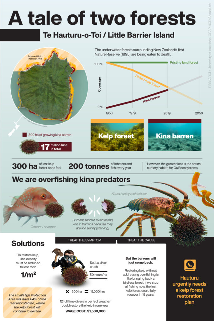
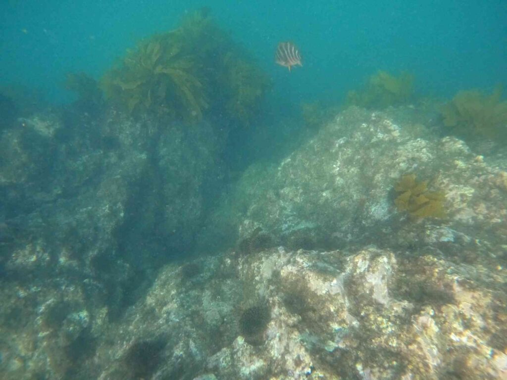
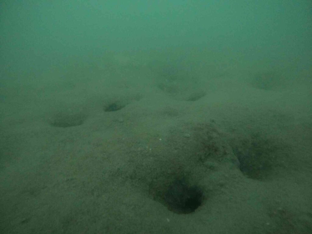
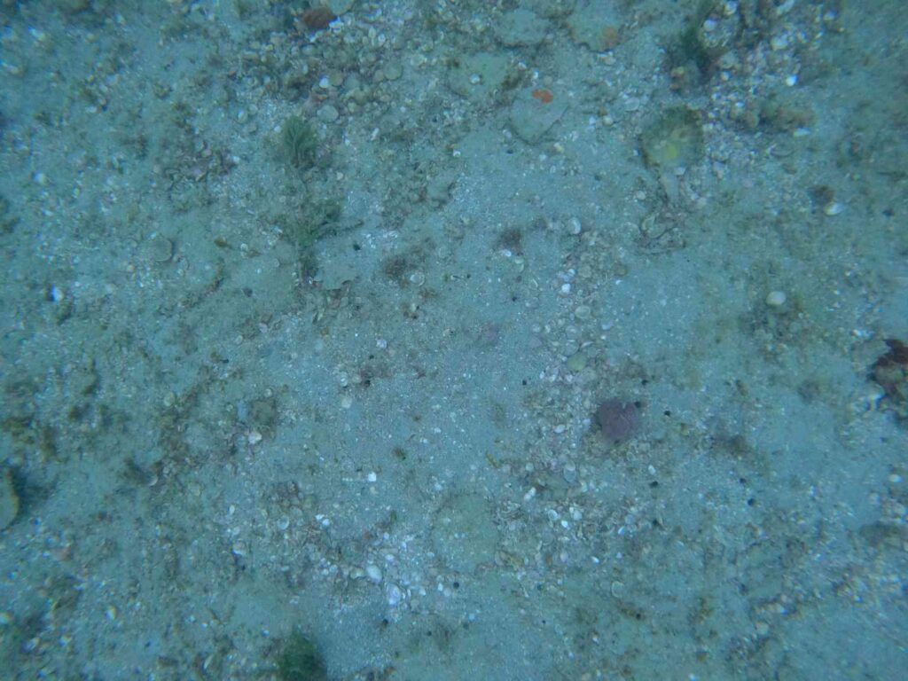
Inconclusive evidence of the cause of kina barren formation?

In an article titled Shane Jones sets sights on killer kina – An industrial grade problem the Fisheries Minister Shane Jones is quoted as saying “Some ecologists say it’s related to overfishing but the evidence is not conclusive in that regard. From my perspective as Fisheries Minister, I can provide some practical tools through the law, to allow local communities to go and cull them.”

The consultation document on the proposed tool provides a definition of kina barrens and clearly explains they are formed by a “low abundance of predator species“.

I was concerned that our Fisheries Minister could be so poorly informed so I asked Fisheries New Zealand for:

  1. Any recent New Zealand research findings that corroborate the Minister’s statement that the cause of kina barens is inconclusive.
  2. Any ministerial advice provided to the Minister that supports his statement about the formation of kina barrens.

Fisheries New Zealand replied in detail today with recent information that has been provided to the Minister with respect to kina and kina barrens (note I have run the scanned pages through a text recognition software).

Fisheries New Zealand have clearly supplied conclusive evidence that kina barrens are related to overfishing. They have not supplied any research findings that corroborate the Minister’s statement that the cause of kina barens is inconclusive. I don’t know where Shane Jones is getting his alternative facts.

Of interest (and to his credit) Shane Jones has asked staff to increase the pace on starting pre-engagement to identify voluntary and/or regulatory measures to support increased large rock lobster abundance in areas with kina barrens (p25, detail on p21). Progress on this workstream seems to have been withheld and its clearly delayed as the other (extractive) measures mentioned have been consulted on. Two new measures that staff have suggested include a Maximum Legal Size Limit for Lobster and ‘Catch Spreading’.

While we wait for government action, millions of kina relentlessly devour our kelp forests.

Submissions from the last few months

Shane Jones, Fast-track Bill

Changes in reporting for inshore fishing boats with cameras

There is some confusion about the change in these numbers because of the way the data was reported. I made this graphic to also clear up that as of April 2024 there is no data that has been made public from the on-board cameras for commercial fishing vessels programme.

Data sources: Overview of the rollout of on-board cameras on commercial fishing vessels February 2024 Update at 1 April 2024: Progress on the rollout

Record oystercatcher chick at Tahuna Torea

This summer Tōrea pango / Variable Oystercatcher have nested for the first time at Tahuna Torea Nature Reserve (written records began in the 1970’s). Its also the first time any bird has nested on the man-made shorebird roosts (or islands) in the lagoon. Tōrea Pango are recovering from being threatened with extinction and are one of the most endangered breeding birds in the Eastern Songbird Project area. The nearest breeding area is Motukorea / Browns Island which is a population sink for the species. The reserves name ‘torea’ does not come from this species but the South Island Pied Oystercatcher which once gathered here in great numbers.

The two egg nest was laid days after I trimmed the vegetation on Kuaka Island mid November 2023 as part of a roost restoration project. A team of local bird watchers kept a close eye on the nest. The mud in the lagoon keeps the cats out, but not the rats, the trapping team stepped up efforts and rats stopped turning up on the trail camera. One of the eggs was not fertile but the other one was and the bird watching team was thrilled when a chick hatched just in time for Christmas.

Tōrea Pango Chick on Kuaka Island. Photo by Shaun Lee.

The nest would not likely have survived a kiteboarding event in the lagoon. Thanks to the kiteboarders for volunteering to stop kiting in the lagoon at high tide. If you do see anyone kiting in the lagoon phone me 021 555 425 and I’ll have a chat to them.

Tōrea pango whanau at Cable Beacon Point. Photo by Basil Avery.

It was interesting that after nesting on Kuaka Island where I had trimmed vegetation and where a small amount of mangroves have been removed (not the majority) the parents then took the chick 400 m southeast to Cable Beacon Point. New mangrove stumps here were used by the chick to hide. I put up a sign and the bird watchers were on high alert for a few weeks until the chick fledged. The Tōrea pango whanau have stayed in the area which is a great endorsement of the reserve from our feathered friends and a huge win for our shorebird habitat restoration efforts.

The fledged Tōrea pango chick. Photo by Shaun Lee.

The unmanaged fisheries of the Hauraki Gulf Marine Park

In New Zealand, we have 75 fish populations that are supposed to be managed sustainably. The main way we do this is by setting limits on how many fish can be caught, known as the Total Allowable Catch (TAC). We don’t keep regular track of the fish caught by recreational and cultural fishers. The only annual numbers are for commercial fishing, which has a limit called the Total Allowable Commercial Catch (TACC).

What’s puzzling is that for many fish populations, the TACC is set way higher than what’s actually being caught, and it’s been like that for years without any change. To me, this means these fish aren’t really being managed at all. Of the 75 in Aotearoa there are 16 fish populations in the Gulf that stand out as ‘unmanaged’ due to their TACC being significantly higher than the actual catches.

I had high hopes for the new Fisheries Management Plan for the Gulf, thinking it might sort out these unmanaged populations. I tried to get some answers by writing to the minister, and when that didn’t work, I filed an Official Information Act request. The reply came from Simon Lawrence at Fisheries New Zealand, but it wasn’t what I hoped for. They’re only planning to review four out of the 16 unmanaged populations this year – Flatfish, Rig, Blue cod, and Red cod. That leaves Pipi, Horse mussel, Paddle crab, Anchovy, Sprat, Pilchard, Jack mackerel, Pōrae, Leatherjacket, Trumpeter, Longfin eel and Spiny dogfish unmanaged. Four of these fish are at the bottom of the food web and are critical for the Gulf ecosystem function. Horse mussels are endemic (found only in New Zealand) and aggregations dense enough to be called beds are now extinct in the Gulf, Longfin eel are also endemic and going extinct.

So here we are, with a fisheries plan that talks a big game about moving towards an ‘ecosystem-based fisheries management‘ approach, but we’re not even effectively managing individual fish populations.

Anchovy Engraulis australis kokowhaawhaa
 Jack mackerel Trachurus declivis Trachurus novaezelandia Trachurus murphyi Haature
New Zealand pilchard Sardinops sagax Mohimohi
New Zealand sprat Sprattus muelleri Kupae
Smooth leatherjacket velvet leatherjacket Meuschenia scaber Kokiri
Trumpeter Latris lineata Kohikohi
Porae Nemadactylus douglasii Morwong
Spiny dogfish Squalus acanthias snow fillets Makohuarau Pioke
Longfin eel Anguilla dieffenbachii Tuna
paddle crab  Ovalipes catharus Pāpaka
horse mussel Atrina zelandica Hururoa
pipi  Paphies australis

Early analysis of submissions on the Hauraki Gulf / Tīkapa Moana Marine Protection Bill

Submissions on the Hauraki Gulf / Tīkapa Moana Marine Protection Bill began to come online here on the 17th of January 2024. There are about 6,540 submissions so far, some have supplementary material. I have been playing with ChatGPT to write Python code to download and categorise the submissions and supplementary material.

I downloaded 7,586 PDFs. It looks like at least 70% of the submissions came from here or have similar concerns as 5,518 PDFs include one of these words / terms ” racist”, ” all people of New Zealand”, ” ancestral”, ” all New Zealanders”, ” race”, ” racism”, ” racial”, ” remove acknowledgment of customary rights”, ” customary rights should not exist”, ” oppose the customary fishing rights”, ” 1 set of rules”, ” one set of rules”, ” one law for all”, ” all people”, ” one people”, ” people equally”, ” apply to everyone”, ” skin colour”, ” discrimination”, ” apartheid”, ” separatist”, ” all citizens”, ” for all to enjoy”, ” all the people”, ” all people”, ” treated differently”, ” select group to fish”, ” one law”, ” exception for any group”, ” any one group”, ” regardless of ancestry”, ” same rights” or ” divide the people”.

Note that nearly all these submissions support the protection measures in the bill, but object to customary rights. The number of submissions appears to be increasing daily as they are processed by parliamentary staff.

Surveying a kuakua / large dog cockle shell drift

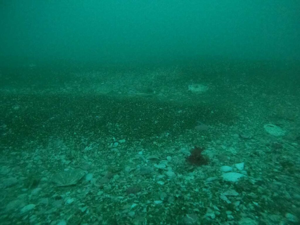
I was stoked to stumble across this kuakua shell drift North West of Waiheke Island. It adds a lot of complexity to the seafloor and is fun to explore because of the biodiversity it hosts. I imagined it was one large drift that I could map by attempting to swim around it at slack tide. To do this I dragged a float on the surface with my son’s phone attached. The phone was using MapMyRun as I am very familiar with the app. A plastic container was screwed to the float to hold the phone which was encased in two plastic bags, the lid of the container was also taped to the float). I had a friend on the surface follow me in a small boat with a Garmin Explorer Plus (this also helped with safety and was essential to help me get back to the boat against the current).

Edge of the kuakua shell drift

The bed is dominated by kuakua but also included large long trough shells (Oxyperas elongatum) and tipa / scallop shells further out. I used these large shells as the edge of the drift rather than the smaller shells. It was tempting to use the high contrast line created by dark red algae growing on undisturbed (but often smaller tawera spissa) shells which contrasted with the white shell hash. I took my phone to record marine life, logged on iNaturalist.nz. Many of the sponges were hard to identify as I was not using a dive light and the warm colours are missing.

The time stamps on my photos and the length of the dive on my dive computer were useful but the timestamps on the individual tracking points on the Garmin were essential to identify the dive path. This is because I needed to remove tracking points generated:

  1. Before the dive from boat movement
  2. While I drifted during my safety stop
  3. After the dive while being towed back to my boat

Although I ran out of air before I could get around the whole drift (44minute dive) the tracking data gives a sense for the size of the drift. By joining the start and endpoints the track roughly made a four sided shape for which I could calculate the area (16,813m2 or 0.017km2) by dividing it into two triangles and applying Heron’s Formula.

There were some small gaps in the drift and I’m sure the habitat exits outside the area I tried to circle, I felt like it was more dense in the NW where there was also more tipa shell. I’d like to make a little drop camera to get a better sense for the seafloor habitats surrounding the surveyed area. I would also like to try doing some photogrammetry showing the diversity in the drift , to do this I need to build a cage for my GoPro that I can attach lights to.

New Zealand’s dairy industry

New Zealand dairy industry

Environmental reports and main stream media are often critical of different aspects of the New Zealand dairy industry. Here I summarise them together in one graphic. View at higher resolution by clicking on the image below.

Graphic summary of the New Zealand’s dairy industries impacts.

References – resources for further reading on the impacts of New Zealand’s dairy industry.

Map of dog prohibited area at Tahuna Torea Nature Reserve

Map of dog prohibited area at Tahuna Torea Nature Reserve

Like many locals I regularly ask people to not walk their dog at Tahuna Torea Nature Reserve. Sometimes dog walkers push back and say they are allowed to walk their dogs on the beach or around the top of the track. To make it clear here is the wording from the Auckland Council website:

“Dogs are prohibited at all times in Tahuna Torea Nature Reserve. This covers all park areas and associated beach and foreshore areas from the public walkway between 24 and 26 Vista Cresent to its boundary on West Tamaki and Tahaki Roads.”

Here is a map to visually explain the area.

To map the “beach and foreshore areas”, I projected the boundaries perpendicular to the starting points on land, down to the low tide line. Mean Low Water Springs (MLWS) has been visually estimated.

Update March 2024

Roberta Reserve also excludes dogs on the foreshore and playground. There is an exemption for the area in the water of the stream mouth seaward side of the bridge on Roberta Reserve.